Pico Simón Bolívar
| Sierra Nevada de Santa Marta | |
|---|---|
 |
|
| Highest point | |
| Peak | Pico Simón Bolívar |
| Elevation | 5,700 m (18,700 ft) |
| Coordinates | 10°52′00″N 73°43′12″W / 10.86667°N 73.72000°WCoordinates: 10°52′00″N 73°43′12″W / 10.86667°N 73.72000°W |
| Geography | |
| Country | Colombia |
| PNN Sierra Nevada de Santa Marta | |
|---|---|
| Sierra Nevada de Santa Marta National Natural Park | |
|
IUCN category II (national park)
|
|

Sierra Nevada viewed from Valledupar
|
|
| Nearest city |
Santa Marta, |
| Area | 3,830 km2 (1,480 sq mi) |
| Established | 1964 |
| Governing body | SINAP |
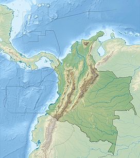
The Sierra Nevada de Santa Marta is an isolated mountain range separated from the Andes chain that runs through Colombia. Reaching an altitude of 5,700 m (18,700 ft) just 42 km (26 mi) from the Caribbean coast, the Sierra Nevada is one of the world's highest coastal ranges, being a few hundred feet shorter than the Saint Elias Mountains in Canada. The Sierra Nevada encompasses about 17,000 km2 (6,600 sq mi) and serves as the source of 36 rivers. The range is in the Departments of Magdalena, Cesar and La Guajira.
The highest point of the Sierra Nevada group (and Colombia in general) may be either Pico Cristóbal Colón or Pico Simón Bolívar both in the municipalities of Santa Marta and Aracataca; it has yet to be determined which is higher. SRTM data and local topographic maps show that their true elevations are approximately 5,700 m (18,700 ft), lower than the 5,775 m (18,947 ft) elevation that is often quoted.
The Sierra Nevada is a compact group, relatively small in area, and completely surrounded by lands with elevations below 200 m (660 ft). Although it is associated with the Tropical Andes, the main backbone of the Andes cannot be reached from the Sierra Nevada without dropping below this level. This makes its highest point the world's fifth most prominent summit.
Several peaks in the Sierra Nevada are intervisible with Cerro Paramillo, a 3,730 m (12,240 ft) peak in Antioquia Department. This implies a theoretical direct line of sight of just over 500 km (310 mi), reported to be the longest between any two points on the surface of the Earth.
It is calculated that the yearly average rainfall is 4,000 mm (160 in) at elevations of 500 m (1,600 ft) to 1,500 m (4,900 ft). The temperature varies between 0 °C and 27 °C.(32-81 °F)
The tropical rainforest is made up of perennial trees, with a canopy reaching between 30 m (98 ft) to 40 m (130 ft). There is a great variety and large populations of epiphytes and lianas, and more than 3,000 species of vascular plants are found in the area. The indigenous peoples made an alcoholic beverage from fruits of the palm Attalea maripa found at the lower elevations.
...
Wikipedia

