Phoenixville, Pennsylvania
| Borough of Phoenixville | |
| Borough | |
| Country | United States |
|---|---|
| State | Pennsylvania |
| County | Chester |
| Elevation | 138 ft (42.1 m) |
| Coordinates | 40°07′51″N 75°31′09″W / 40.13083°N 75.51917°WCoordinates: 40°07′51″N 75°31′09″W / 40.13083°N 75.51917°W |
| Area | 3.8 sq mi (9.8 km2) |
| - land | 3.6 sq mi (9 km2) |
| - water | 0.2 sq mi (1 km2), 5.26% |
| Population | 16,518 (2012) |
| Density | 4,566.6/sq mi (1,763.2/km2) |
| Mayor | Michael J. Speck |
| Timezone | EST (UTC-5) |
| - summer (DST) | EDT (UTC-4) |
| ZIP code | 19460 |
| Area code | 610/484 |
|
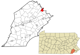
Location in Chester County and the state of Pennsylvania.
|
|
|
Location of Pennsylvania in the United States
|
|
|
Website: www |
|
Phoenixville is a borough in Chester County, Pennsylvania, United States, 28 miles (45 km) northwest of Philadelphia, at the junction of French Creek with the Schuylkill River. It is located in the Philadelphia Metro Area. The population is 16,440 as of the 2010 Census.
Originally called Manavon, Phoenixville was settled in 1732 and incorporated as a borough in 1849. In its industrial heyday early in the twentieth century, it was an important manufacturing center and it was the site of great iron and steel mills such as the Phoenix Iron Works, boiler works, silk mill, underwear and hosiery factories, a match factory, and the famous (and now highly collectible) Etruscan majolica pottery. Like many American towns and cities, Phoenixville owes its growth to its waterways. It is not only situated on the broad Schuylkill River, a historic thoroughfare to Native Americans and early settlers alike, but it is bisected by the fast-flowing French Creek, which was quickly harnessed for water power.
Much of this history was recognized by the creation of the Phoenixville Historic District, the largest National Register of Historic Places site in Chester County. The Black Rock Bridge, Gay Street School, and Schuylkill Navigation Canal, Oakes Reach Section are also listed on the National Register of Historic Places.
...
Wikipedia


