Phippsburg
| Phippsburg, Maine | |
|---|---|
| Town | |

|
|
| Nickname(s): The Burg | |
| Location within the state of Maine | |
| Coordinates: 43°47′35″N 69°49′4″W / 43.79306°N 69.81778°W | |
| Country | United States |
| State | Maine |
| County | Sagadahoc |
| Incorporated | 1814 |
| Area | |
| • Total | 71.20 sq mi (184.41 km2) |
| • Land | 28.58 sq mi (74.02 km2) |
| • Water | 42.62 sq mi (110.39 km2) |
| Elevation | 128 ft (39 m) |
| Population (2010) | |
| • Total | 2,216 |
| • Estimate (2012) | 2,226 |
| • Density | 77.5/sq mi (29.9/km2) |
| Time zone | Eastern (EST) (UTC-5) |
| • Summer (DST) | EDT (UTC-4) |
| ZIP codes | 04562, 04567 |
| Area code(s) | 207 |
| FIPS code | 23-58515 |
| GNIS feature ID | 0582675 |
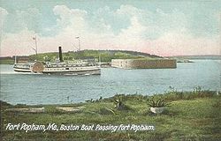
Phippsburg is a town in Sagadahoc County, Maine, United States, on the west side of the mouth of the Kennebec River. The population was 2,216 at the 2010 census. It is within the Portland–South Portland–Biddeford, Maine, metropolitan statistical area. A tourist destination, Phippsburg is home to Bates-Morse Mountain Conservation Area, Fort Popham State Historic Site; it is also home to Fort Baldwin which overlooks Fort Popham, and Popham Beach State Park, as well as Pond Island National Wildlife Refuge. The town includes part of Winnegance.
Site of the Popham Colony, Phippsburg was — between 1607 and 1608 — the first known English settlement attempt in New England. During its brief existence, colonists built Virginia of Sagadahoc, the first ship in Maine's long history of shipbuilding.
The next British settlement at the mouth of the Kennebec River began in 1653; Thomas Atkins, a fisherman, purchased from the sachem Mowhotiwormet, commonly called Chief Robinhood, the southern end of Phippsburg (with the exception of Popham). Atkins Bay bears his name. The population gradually increased until King Philip's War, when Indians in August 1676 attacked the eastern side of the Kennebec River, and scalping the colonists, or else carrying them into captivity. Dwellings were burned and stocks of cattle killed. The entire area was abandoned.
...
Wikipedia

