Pfannenstiel (mountain)
| Pfannenstiel | |
|---|---|

Pfannenstiel (background centre) and Lake Zürich from the Etzel
|
|
| Highest point | |
| Elevation | 853 m (2,799 ft) |
| Prominence | 333 m (1,093 ft) |
| Isolation | 10.2 km (6.3 mi) |
| Parent peak | Tweralpspitz |
| Coordinates | 47°17′30″N 8°40′17″E / 47.29167°N 8.67139°ECoordinates: 47°17′30″N 8°40′17″E / 47.29167°N 8.67139°E |
| Geography | |
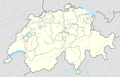
| Location | Zürich, Switzerland |
Pfannenstiel (el. 853 metres (2,799 ft)) is a wooded mountain respectively a region overlooking the Lake Zürich and Zürcher Oberland in the canton of Zürich in Switzerland.
Pfannenstiel (Swiss German: Pfannenstil meaning pan handle) is commonly used for the mountain and the region of a longish mountain area. It is located in the district of Meilen, some 15 km (9.3 mi) in the southeast of the city of Zürich, bordered by Greifensee and Zürcher Oberland in the northeast, Lake Zürich in the southwest and the area around the municipality of Hombrechtikon in the east. In the northwest, Pfannenstiel is bordered by the village of Forch and a former mountain pass (668 metres (2,192 ft)) leading from Glatt valley to the Lake Zürich shore. Its highest point (Okenshöhe) is about 450 metres above the Lake Zürich. From southeast to northwest, Pfannenstiel is part of a chain of peaks respectively mountains: Guldenen (778 metres (2,552 ft)), Wassberg (715 metres (2,346 ft)), Öschbrig (696 metres (2,283 ft)), Adlisberg (701 metres (2,300 ft)), Zürichberg (676 metres (2,218 ft)), Käferberg-Waidberg (601 metres (1,972 ft)) and Hönggerberg (541 metres (1,775 ft)).
The area alongside Lake Zürich had been formed as the left moraine of the Ice Age glacier, the bed of which is now the Lake Zürich.
...
Wikipedia

