Forch
| Forch | |
|---|---|

|
|
| Elevation | 682 m (2,238 ft) |
| Traversed by | Road |
| Location | Canton of Zürich, Switzerland |
| Range | Pfannenstiel (Zürich) |
| Coordinates | 47°19.5′N 8°39.2′E / 47.3250°N 8.6533°ECoordinates: 47°19.5′N 8°39.2′E / 47.3250°N 8.6533°E |
|
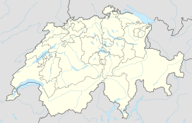
Location in Switzerland
|
|
Forch is a village and a mountain pass (el. 682 m (2,238 ft)) located in the municipalities of Küsnacht and Maur in the canton of Zürich, Switzerland.
Forch is located approximately 10 km (6.2 mi) in the southeast of Zürich, nearby Zumikon and Maur. It includes the hamlets Aesch and Scheuren (villages of the municipality Maur), and Kaltenstein in the east of the pass, Wangen and Neue Forch, which are villages of the municipality of Küsnacht. The forested hill called Guldenen on Pfannenstiel belongs to the Forch area, Hinter Guldenen to the municipality of Maur and Vorder Guldenen is part of the municipality of Egg.
The mountain pass named Forch connects Küsnacht on Lake Zürich and Maur on Greifensee respectively in the Glatt Valley. A monument called Wehrmännerdenkmal commemorating World War I is located nearby Neue Forch and Wassberg hill (el. 851 metres (2,792 ft)), which is also a popular recreation area for the people of the city of Zürich.
The population of the village of Forch is about 3,004 (as of 2013[update]). The village has preserved its rural character. Since 1912, Forch is a stop of the Forchbahn, a tramway of the S-Bahn Zürich, between the Stadelhoferplatz in Zürich and the municipality of Esslingen. Forch village is connected by the A52 highway to Zumikon (to the west) and Hinwil (to the east) heading to the Zürcher Oberland. Thanks to these good conditions, Forch is the biggest village within the municipality of Maur. Nevertheless, its infrastructure, apart from Kindergarten, primary school, post office, retail facilities and hospitality is modest, i.e. most infrastructure facilities are located in Maur and Küsnacht.
...
Wikipedia

