Petworth, Washington, D.C.
| Petworth | |
|---|---|
| Neighborhoods in Washington, D.C. | |

"(Here I Stand) In the Spirit of Paul Robeson" by Allen Uzikee Nelson, 2001. Corner of Georgia and Kansas Avenues NW
|
|
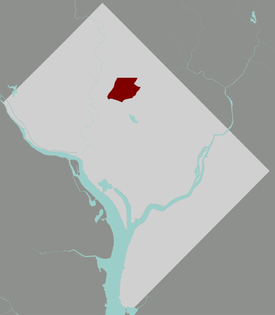
 Map of the District of Columbia, with Petworth highlighted in red |
|
| Coordinates: 38°56′32″N 77°01′32″W / 38.942161°N 77.025525°W | |
| Country |
|
| State/District |
|
| Quadrant | Northwest |
| Ward | Ward 4 |
| Advisory Neighborhood Commission | ANC 4C; ANC 4D |
| Government | |
| • Councilmember | Brandon Todd |
| • Delegate to the U.S. Congress | Eleanor Holmes Norton |
| Area | |
| • Land | 0.91 sq mi (2.4 km2) |
| Elevation | 188.0 ft (57.3 m) |
| Time zone | EST (UTC-5) |
| ZIP Code | 20010, 20011 |
| Area code(s) | 202 |
Petworth is a residential neighborhood in the Northwest quadrant of Washington, D.C.. It is bounded to the east by the Soldiers’ Home and Rock Creek Church Yard and Cemetery, to the west by Arkansas Avenue NW, to the south by Rock Creek Church Road NW and Spring Road NW, and to the north by Hamilton Street NW.
Petworth is represented on the Council of the District of Columbia by the Ward 4 council member: since May 2015, Brandon Todd.Muriel Bowser served as Ward 4 councilmember until she became the city's mayor on January 2, 2015.
Petworth was the name of the 205-acre country estate of John Tayloe III, bequeathed to his son Benjamin Ogle Tayloe, located at the northeast corner of 7th Street Pike (later known as Brightwood Avenue, now Georgia Avenue) and Rock Creek Church Road. In 1887, it was sold by Tayloe's heirs to developers for $107,000. In 1889, developers registered “Petworth” with the District surveyor as a 387-acre plat of subdivision containing the former Tayloe estate and the Marshal Brown estate. In 1893, additional real estate deals formed "West Petworth," from land west of Brightwood Avenue, including the Ruppert Farm, which was sold for $142,680, the 20-acre Burnaby tract, and a 14-acre property known as Poor Tom’s Last Shaft. In 1900, Henry J. Ruppert sold an additional 31.7 acres west of Brightwood and Iowa Avenues and south of Utica Street (now Allison Street) to the District for a proposed municipal hospital.
The neighborhood bloomed with the expansion of the streetcar line up Georgia Avenue from Florida Avenue to the Washington, D.C., line at Silver Spring, Maryland.
...
Wikipedia
