Petah Tikva
Petah Tikva
|
||
|---|---|---|
| Hebrew transcription(s) | ||
| • Also spelled | Petah Tiqwa (official) Petach Tikvah (unofficial) |
|
 |
||
|
||
| Coordinates: 32°05′19.78″N 34°53′10.8″E / 32.0888278°N 34.886333°ECoordinates: 32°05′19.78″N 34°53′10.8″E / 32.0888278°N 34.886333°E | ||
| Country | Israel | |
| District | Central | |
| Founded | 1878 | |
| Government | ||
| • Type | City (from 1937) | |
| • Mayor | Itzik Braverman | |
| Area | ||
| • Total | 35,868 dunams (35.868 km2 or 13.849 sq mi) | |
| Population (2015) | ||
| • Total | 230,984 | |
| Name meaning | Opening of hope | |
Petah Tikva (Hebrew: פֶּתַח תִּקְוָה, IPA: [ˈpetaχ tikˈva], "Opening of Hope"; Arabic: بتاح تكفا) known as Em HaMoshavot ("Mother of the Moshavot"), is a city in the Central District of Israel, 10.6 km (6.59 mi) east of Tel Aviv. It was founded in 1878, mainly by religious orthodox Jews, also known as the Old Yishuv, and became a permanent settlement in 1883 with the financial help of Baron Edmond de Rothschild.
In 2015 the city had a population of 230,984. The population density is approximately 6,277 inhabitants per square kilometre (16,260/sq mi). Petah Tikva's jurisdiction covers 35,868 dunams (~35.9 km2 or 15 sq mi). It is part of the Tel Aviv Metropolitan Area.
The name of Petah Tikva was chosen by its founders in 1878 from the prophecy of Hosea (2:15, 2:17 Jewish), "And I will give her vineyards from thence, and the Valley of Achor for an opening of hope: and she shall sing there, as in the days of her youth, and as in the day when she came up out of the land of Egypt."
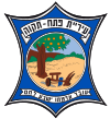
Petah Tikva's emblem appears on a postage stamp designed by Yitzhak Goldenhirsch, a founding member of Petah Tikva. The plow symbolizes Petah Tikva's origins as an agricultural settlement, the field symbolizes the drying of the Yarkon River swamps and cultivation of the land, and the orange tree symbolizes Petah Tikva's citrus industry, starting with the first tree planted by Rabbi Aryeh Leib Frumkin.
...
Wikipedia


