Penydarren House
Penydarren
|
|
|---|---|
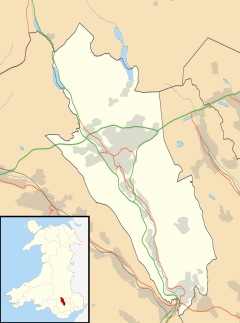
| Penydarren shown within Merthyr Tydfil | |
| Population | 5,419 (2011) |
| OS grid reference | SO055075 |
| Principal area | |
| Ceremonial county | |
| Country | Wales |
| Sovereign state | United Kingdom |
| Post town | Merthyr Tydfil |
| Postcode district | CF47 |
| Dialling code | 01685 38 |
| Police | South Wales |
| Fire | South Wales |
| Ambulance | Welsh |
| EU Parliament | Wales |
| UK Parliament | |
| Welsh Assembly | |
|
|||||||||
|
|||||||||
|
|||||||||
| Type and origin | |
|---|---|
| Power type | Steam |
| Builder | Richard Trevithick |
| Build date | 1803 |
| Specifications | |
|---|---|
| Configuration | 0-4-0 |
| Career | |
|---|---|
| Operators | Merthyr Tydfil Tramroad |
Penydarren (Welsh: Penydarren) is a community in Merthyr Tydfil County Borough in Wales.
The area is most notable for being the site of a 1st-century Roman fort, and during the Industrial Revolution it housed Penydarren Ironworks the third largest of the great Merthyr works. Penydarren was also used by Richard Trevithick as the location for his experiments into steam locomotion. The community and ward has a population of 5,253, increasing to 5,419 at the 2011 Census.
Penydarren Park, the site of the Roman fort and the football ground, is today outside the community boundary.
Being located on a spur of land 700 feet (210 m) above sea level, just southwest of the River Taff, made Pen-y-Darren an ideal location to build an occupation outpost fort for the Romans in AD75, during the governorship of Sextus Julius Frontinus. It was during this period that he subdued the Silures and other hostile tribes of Wales by establishing a new base at Caerleon or Isca Augusta for Legio II Augusta, and this was one of a network of smaller forts fifteen to twenty kilometres apart for his auxiliary units.
The only information known about the fort is from the later excavations undertaken during the construction of the football stadium in 1905 by Frank Treharne-James, and in 1957 during the demolition of Penydarren House.
From the combination of these works, it is presently estimated that the fort had a turf and clay rampart 8.2 metres (27 ft) wide, set on a cobble foundation and separated by a narrow berm of 0.6 metres (2 ft 0 in) wide from its double ditch. The inner ditch was 0.4 metres (1 ft 4 in) wide, the outer 0.3 metres (1 ft 0 in) wide, separated by a berm of 2.5 metres (8 ft 2 in). If a well recorded by Treharne-James in 1905 was centrally placed within the principia, and a square outline is assumed, then the fort had dimensions of 152 metres (499 ft) across the rampart crests, covering an area of 2.3 hectares (5.7 acres).
...
Wikipedia

