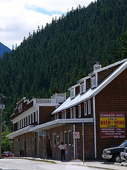
Pemberton, British Columbia
| Pemberton | |
|---|---|
| Village | |
| Village of Pemberton | |
 |
|
| Location of Pemberton in British Columbia | |
| Coordinates: 50°19′3″N 122°47′55″W / 50.31750°N 122.79861°W | |
| Country |
|
| Province |
|
| Region | Pemberton Valley (Sea to Sky Country/Lillooet Country) |
| Regional district | Squamish-Lillooet |
| Incorporated | 1956 |
| Government | |
| • Type | Elected village council |
| • Governing body | Pemberton Village Council |
| • Mayor | Mike Richman |
| Area | |
| • Total | 10.89 km2 (4.20 sq mi) |
| Elevation | 210 m (690 ft) |
| Population (2013) | |
| • Total | 2,436 |
| • Density | 217.5/km2 (563/sq mi) |
| Time zone | PST (UTC−8) |
| • Summer (DST) | PDT (UTC−7) |
| Postal code | V0N |
| Area code(s) | 604 / 778 / 236 |
| Highways |
|
| Website | http://www.pemberton.ca/ |
Pemberton is a village municipality north of Whistler in the Pemberton Valley of British Columbia in Canada, with a population of 2,192. Until the 1960s the village could be reached only by train, but that changed when Highway 99 was built through Whistler (then named Alta Lake) and Pemberton.
Pemberton, British Columbia, Canada, is a small village located in the Coast Mountains, 100 miles (159 km) north of Vancouver. Pemberton has a population of approximately 2,500 people. Until the early 1960s, when Highway 99 was built, Pemberton was accessible only by train and the population was under 200 people.
Pemberton is known as the "Seed Potato Capital of the World" due to its production of virus-free seed potatoes. The local economy is also dependent on logging and tourism. Mt. Currie rises to the south, at 8,500 ft (2,591 m), and can be seen throughout the Pemberton Valley.
Forest service roads brought forest service campsites, trail heads, view points and access to many of the lakes, mountains, and hot springs in the area.
The climate of Pemberton is very warm and dry in the summer and mild and wet in the winter. Pemberton is an ecologically complex and diverse zone which is referred to as the Coast-Interior Transition zone. Moving from west to east in the direction of the prevailing winds and taking into consideration the elevation changes; it follows that there is a windward, wetter zone and a leeward drier zone and an even drier zone on the leeward side of the Lillooet Ranges and the Pacific Ranges north of the rail line. High summer temperatures and the pronounced water deficits during the growing season are the norm.
Herbivores / ungulates: Hybrid black-tailed deer / mule deer, elk, moose, mountain goats, and mountain sheep
...
Wikipedia

