Pelsall
| Pelsall | |
|---|---|
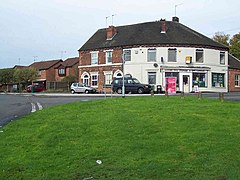
 Junction of Mouse Hill and Foundry Lane, Pelsall |
|
| Pelsall shown within the West Midlands | |
| Population | 11,505 (2011.Ward) |
| OS grid reference | SK020037 |
| Metropolitan borough | |
| Metropolitan county | |
| Region | |
| Country | England |
| Sovereign state | United Kingdom |
| Post town | WALSALL |
| Postcode district | WS3 |
| Police | West Midlands |
| Fire | West Midlands |
| Ambulance | West Midlands |
| EU Parliament | West Midlands |
| UK Parliament | |
Pelsall is a suburban village and civil parish, situated in the Metropolitan Borough of Walsall in the West Midlands, England.
Pelsall was first mentioned in a charter of 994, when it was among various lands given to the monastery at Heantune (Wolverhampton) by Wulfrun, a Mercian noblewoman. At this time it was called Peolshalh, meaning 'a nook' or 'land between two streams belonging to Peol'. The Domesday entry of 1086 describes Pelsall as being waste, still belonging to the church.
A chapel of ease was built in about 1311. The medieval population was small and a return of 1563 lists only 14 householders. The original centre of the village was the area now known as Old Town. In 1760 the remaining open fields were enclosed, but some holdings survived into the next century in Hall Field, High Ley, The Riddings Field and Final Field. The tithe map of about 1840 records some evidence of the medieval strip farming system.
In the second quarter of the 19th century clusters of houses were built on the fringes of the extensive commonland and at the Newlands. The greatest concentration was in what is now the village centre. This area gradually developed; a Methodist Chapel and school were opened in about 1836, in the modern day Station Road and a new St Michael's Church was built in 1844 – the old one in Paradise Lane had been considered too small for the growing population. Towards the end of the 19th century shops became established in Norton Road and High Street. The population in 1801 was 477 and by 1901 had grown to 3,626.
Pelsall had become a mining village; in places deposits of coal were found only a few yards from the surface and by about 1800 the shallow and deep seams were 'much worked'. The cutting of the canal in about 1794 opened up the area for industrialisation, with entrepreneurs and landowners quickly exploiting the mineral wealth. Nailmaking, traditionally a cottage industry, was also carried out locally; in the census of 1841 thirty men stated this as their occupation.
On 14 November 1872, 22 miners died when the Pelsall Hall Colliery was flooded. 21 of the 22 miners were buried underneath a polished granite obelisk in the churchyard of St Michael and All Angels Church.
...
Wikipedia

