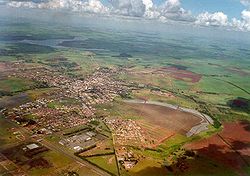
Pederneiras
| Pederneiras | |||
|---|---|---|---|
| Municipality | |||
 |
|||
|
|||
 Location in São Paulo state |
|||
| Location in Brazil | |||
| Coordinates: 22°21′6″S 48°46′30″W / 22.35167°S 48.77500°WCoordinates: 22°21′6″S 48°46′30″W / 22.35167°S 48.77500°W | |||
| Country |
|
||
| Region | Southeast Region | ||
| State | São Paulo | ||
| Area | |||
| • Total | 729 km2 (281 sq mi) | ||
| Population (2015) | |||
| • Total | 44,910 | ||
| • Density | 62/km2 (160/sq mi) | ||
| Time zone | BRT/BRST (UTC-3/-2) | ||
Pederneiras is a municipality in the state of São Paulo in Brazil. The population is 44,910 (2015 est.) in an area of 729 km². The elevation is 475 m above sea level.
Starting from 1842, small villages were established in the area of the Tietê River. In 1848 Manoel dos Santos Simões and his two sons, Manuel Leonel dos Santos and João Leonel dos Santos, established a farm in the parish of Botucatu. They named the farm Pederneiras after the large amount of flint stone in the area. In 1865, the settlement became part of the municipality of Lençóis Paulista. Four years later it became a parish with the name São Sebastião de Alegria. Coffee plantations led to growth of the settlement, and in 1891 it became a separate municipality. In 1895, the town's name was changed back into "Pederneiras".
Most of the residents from Pederneiras used to complain because they had to cross long distances to solve their Judicial matters in Lençóis Paulista only (another municipality located around 35 km distance), due to the Judicial district was settled there. Trying to soften the problem, they changed it from Lençóis Paulista to Jaú (a closer municipality located around 25 km distance) in 1895. Only in 1928 they set the own Judicial district in Pederneiras Town.
The birthday of the municipality is featured by the festival called Nations's Fair, where it is possible to find different kind of shows and different kind of dishes from different nationalities.
Politics in the city is clearly separated into two political party: PV and PSDB, the first represented by the Green colour and the other one represented by the Red colour.
Location: Pederneiras municipality is exactly located in the geographic center of São Paulo state. It makes frontier with the following municipalities: Arealva and Bariri to the north; Boracéia, Itapuí, Bariri and Jaú to the east; Lençóis Paulista and Macatuba to the south; Agudos and Bauru to the west.
Districts: It has three different districts: Guaianás (west); Vanglória (south); Santelmo (north).
Soil: The soil of this place is formed by the Bauru sandstone and by an excellent variety of productive massapé zones.
Vegetation: The quantity of reserves of the native vegetation is very little. There is the replanting of pine and eucalyptus. About 70% of the rural area soil is used for sugarcane plantation and pastures for the cattle.
...
Wikipedia


