Pawnee City, Nebraska
| Pawnee City, Nebraska | |
|---|---|
| City | |

West side of G Street, looking NW from 6th St, 2010
|
|
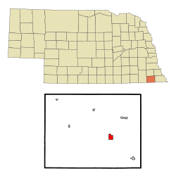
 Location of Pawnee City, Nebraska |
|
| Coordinates: 40°6′38″N 96°9′13″W / 40.11056°N 96.15361°WCoordinates: 40°6′38″N 96°9′13″W / 40.11056°N 96.15361°W | |
| Country | United States |
| State | Nebraska |
| County | Pawnee |
| Incorporated | 1858 |
| Area | |
| • Total | 1.21 sq mi (3.13 km2) |
| • Land | 1.21 sq mi (3.13 km2) |
| • Water | 0 sq mi (0 km2) |
| Elevation | 1,181 ft (360 m) |
| Population (2010) | |
| • Total | 878 |
| • Estimate (2012) | 866 |
| • Density | 730/sq mi (280/km2) |
| Time zone | Central (CST) (UTC-6) |
| • Summer (DST) | CDT (UTC-5) |
| ZIP code | 68420 |
| Area code(s) | 402 |
| FIPS code | 31-38575 |
| GNIS feature ID | 0832001 |
| Website | pawneecity.com |
Pawnee City is a city and county seat of Pawnee County, Nebraska, United States. The population was 878 at the 2010 census.
Pawnee City was incorporated in 1858, and is named after the Pawnee Indian tribe.
By the 1880s, Pawnee City was a railroad town at the junction of two railroad lines.
Pawnee City is located at 40°6′38″N 96°9′13″W / 40.11056°N 96.15361°W (40.110603, −96.153553). According to the United States Census Bureau, the city has a total area of 1.21 square miles (3.13 km2), all of it land.
As of the census of 2010, there were 878 people, 425 households, and 210 families residing in the city. The population density was 725.6 inhabitants per square mile (280.2/km2). There were 518 housing units at an average density of 428.1 per square mile (165.3/km2). The racial makeup of the city was 96.9% White, 0.2% African American, 0.3% Native American, 0.2% Asian, 0.3% from other races, and 1.9% from two or more races. Hispanic or Latino of any race were 2.1% of the population.
...
Wikipedia
