Passaic Park
| Passaic, New Jersey | |
|---|---|
| City | |
| City of Passaic | |

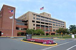
St. Marys Hospital
|
|
 Map of Passaic in Passaic County. Inset: Location of Passaic County highlighted in the State of New Jersey. |
|
 Census Bureau map of Passaic, New Jersey |
|
| Coordinates: 40°51′23″N 74°07′37″W / 40.856413°N 74.12694°WCoordinates: 40°51′23″N 74°07′37″W / 40.856413°N 74.12694°W | |
| Country |
|
| State |
|
| County | Passaic |
| Settled | 1679 |
| Incorporated | April 2, 1873 |
| Government | |
| • Type | Faulkner Act (Mayor-Council) |
| • Body | City Council |
| • Mayor | Hector C. Lora |
| • Administrator | Rick Fernandez |
| • Municipal clerk | Amada Curling |
| Area | |
| • Total | 3.244 sq mi (8.401 km2) |
| • Land | 3.146 sq mi (8.149 km2) |
| • Water | 0.098 sq mi (0.253 km2) 3.01% |
| Area rank | 324th of 566 in state 11th of 16 in county |
| Elevation | 98 ft (30 m) |
| Population (2010 Census) | |
| • Total | 69,781 |
| • Estimate (2016) | 70,635 |
| • Rank | 15th of 566 in state 3rd of 16 in county |
| • Density | 22,179.6/sq mi (8,563.6/km2) |
| • Density rank | 7th of 566 in state 1st of 16 in county |
| Time zone | Eastern (EST) (UTC-5) |
| • Summer (DST) | Eastern (EDT) (UTC-4) |
| ZIP code | 07055 |
| Area code(s) | 973 |
| FIPS code | 3403156550 |
| GNIS feature ID | 0885342 |
| Website | www |
Passaic (/pəˈseɪ.ɪk/ pə-SAY-ik or locally /pəˈseɪk/ pə-SAYK) is a city in Passaic County, New Jersey, United States. As of the 2010 United States Census, the city had a total population of 69,781, maintaining its status as the 15th largest municipality in New Jersey with an increase of 1,920 residents (+2.8%) from the 2000 Census population of 67,861, which had in turn increased by 9,820 (+16.9%) from the 58,041 counted in the 1990 Census. Passaic is the tenth most densely populated municipality in the entire United States with 22,000+ people per square mile.
Located north of Newark on the Passaic River, it was first settled in 1678 by Dutch traders, as Acquackanonk Township. The city and river draw their name from the Lenape word "pahsayèk" which has been variously attributed to mean "valley" or "place where the land splits."
...
Wikipedia
