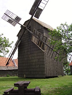
Partutovice
| Partutovice | ||
|---|---|---|
| Municipality | ||
 |
||
|
||
| Coordinates: 49°37′52″N 17°42′28″E / 49.63111°N 17.70778°ECoordinates: 49°37′52″N 17°42′28″E / 49.63111°N 17.70778°E | ||
| Country |
|
|
| Region | Olomouc | |
| District | Přerov | |
| Area | ||
| • Total | 10.05 km2 (3.88 sq mi) | |
| Elevation | 410 m (1,350 ft) | |
| Population (2012) | ||
| • Total | 510 | |
| • Density | 51/km2 (130/sq mi) | |
| Postal code | 753 01 | |
| Website | http://www.partutovice.cz | |
Partutovice is a village and municipality (obec) in Přerov District in the Olomouc Region of the Czech Republic.
The municipality covers an area of 10.05 square kilometres (3.88 sq mi), and has a population of 477 (as at 3 July 2006).
Partutovice lies approximately 27 kilometres (17 mi) north-east of Přerov, 34 km (21 mi) east of Olomouc, and 242 km (150 mi) east of Prague.
...
Wikipedia


