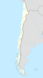
Parral, Chile
| Parral | ||||||
|---|---|---|---|---|---|---|
| City and Commune | ||||||
 |
||||||
|
||||||
| Coordinates (city): 36°09′S 71°50′W / 36.150°S 71.833°WCoordinates: 36°09′S 71°50′W / 36.150°S 71.833°W | ||||||
| Country | Chile | |||||
| Region | Maule | |||||
| Province | Linares | |||||
| Founded | 1795 | |||||
| Founded by | Ambrosio O'Higgins | |||||
| Named for | Maria Luisa of Parma | |||||
| Government | ||||||
| • Type | Municipality | |||||
| • Alcalde | Israel Urrutia Escobar (PDC) | |||||
| Area | ||||||
| • Total | 1,638.4 km2 (632.6 sq mi) | |||||
| Elevation | 162 m (531 ft) | |||||
| Population (2012 Census) | ||||||
| • Total | 38,922 | |||||
| • Density | 24/km2 (62/sq mi) | |||||
| • Urban | 26,397 | |||||
| • Rural | 11,425 | |||||
| Sex | ||||||
| • Men | 18,963 | |||||
| • Women | 18,859 | |||||
| Time zone | CLT (UTC-4) | |||||
| • Summer (DST) | CLST (UTC-3) | |||||
| Postal code | 3630000 | |||||
| Area code(s) | 56 + 73 | |||||
| Website | Official website (Spanish) | |||||
Parral is a city and commune in the Linares Province of Chile's Maule Region.
Parral was founded in 1795 by the Viceroy of Peru, Ambrosio O'Higgins. It was originally named Villa Reina Luisa del Parral in honor of the wife of Carlos IV, the King of Spain.
Parral is the birthplace of poet Pablo Neruda, winner of the Nobel Prize in Literature in 1971.
Parral is located 40 km (25 mi) south of Linares and 97 kilometers south of Talca, on the southern border of the Maule Region and Linares Province. Parral borders on the north with the communes of Longaví, Retiro and Colbún (with which it shares a short border in the cordillerana zone); on the west with the coomune of Cauquenes (Cauquenes Province); on the south with the communes of Ñiquén and San Fabián and Ñuble Province (Bío-Bío Region); and on the east, with the commune of San Fabián.
The commune of Parral is 1,638.4 km2 (632.6 sq mi) in area. Its most important river is the Perquilauquén, which forms its southern border.
...
Wikipedia


