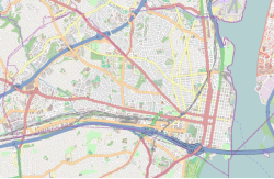
Parkfairfax, Virginia
|
Parkfairfax Historic District
|
|

Preston Road entrance to Parkfairfax
|
|
| Location | Bounded by Quaker Ln., US 395, Beverley Dr., Wellington Rd., Gunston Rd., Valley Dr., Glebe Rd. and Four-mile Run, Alexandria, Virginia |
|---|---|
| Coordinates | 38°50′12″N 77°4′48″W / 38.83667°N 77.08000°WCoordinates: 38°50′12″N 77°4′48″W / 38.83667°N 77.08000°W |
| Area | 132 acres (53 ha) |
| Built | 1941 |
| Architect | Schultz, Leonard and Associates; Clarke, G.D., and Rapuano, Michael |
| Architectural style | Colonial Revival |
| NRHP Reference # | 99000146 |
| VLR # | 100-0151 |
| Significant dates | |
| Added to NRHP | February 22, 1999 |
| Designated VLR | December 10, 1998 |
Parkfairfax is a neighborhood in Alexandria, Virginia, United States, located in the northwestern part of the city near the boundary with Arlington County. Nearby thoroughfares are Interstate 395 (Shirley Highway), State Route 402 (Quaker Lane), and West Glebe Road.
The neighborhood consists of 1,684 townhouse-type condominium apartments in more than 200 buildings on 132 acres (53 ha) built in 1941 and 1942 by Metropolitan Life Insurance Company of New York at the request of U.S. President Franklin Roosevelt to provide housing near the new Pentagon. Like the neighboring Arlington County neighborhood of Fairlington, Parkfairfax is listed on both the National Register of Historic Places and on the Virginia Landmarks Register.
The name is similar to those of other Metropolitan Life projects that use a local area name preceded by "park" (e.g., Parkchester, Parklabrea, and Parkmerced) despite the area not having been a part of Fairfax County since 1801.
...
Wikipedia

