Park Rapids, Minnesota
| Park Rapids, Minnesota | |
|---|---|
| City | |

Photo: Bill Johnson
|
|
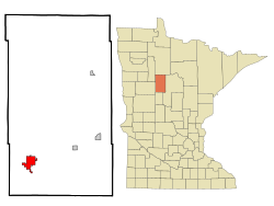
 Location of Park Rapids within Hubbard County and state of Minnesota |
|
| Coordinates: 46°55′N 95°3′W / 46.917°N 95.050°W | |
| Country | United States |
| State | Minnesota |
| County | Hubbard |
| Area | |
| • Total | 6.81 sq mi (17.64 km2) |
| • Land | 6.59 sq mi (17.07 km2) |
| • Water | 0.22 sq mi (0.57 km2) |
| Elevation | 1,440 ft (439 m) |
| Population (2010) | |
| • Total | 3,709 |
| • Estimate (2015) | 3,907 |
| • Density | 562.8/sq mi (217.3/km2) |
| Time zone | Central (CST) (UTC-6) |
| • Summer (DST) | CDT (UTC-5) |
| ZIP code | 56470 |
| Area code(s) | 218 Exchange: 732 |
| FIPS code | 27-49768 |
| GNIS feature ID | 0649151 |
| Website | City of Park Rapids |
Park Rapids is a city in and the county seat of Hubbard County, Minnesota, United States. It is near Itasca State Park, the source of the Mississippi River, as well as the beginning of the Heartland State Trail. The city was founded in 1890 near the Fish Hook River rapids and is located along U.S. Highway 71 and Minnesota State Highway 34. The population was 3,709 at the 2010 census.
Park Rapids became a city in 1890, and was named by Frank C. Rice after the park groves and prairies beside the Fish Hook River rapids. These rapids have since been dammed.
Park Rapids and the surrounding Hubbard County area have three major transportation services. For air travel, Park Rapids is serviced by the Municipal–Konshok Field Airport. According to the FAA, the airfield is publicly owned by the City of Park Rapids and has a physical address of 212 W. 2nd Street, Park Rapids, MN 56470. Also serving the Park Rapids and Hubbard County area for ground transportation is the Hubbard County Heartland Express bus service and a local taxi service.
U.S. Highway 71 and Minnesota State Highway 34 are two of the main routes through Park Rapids. Highway 34 was expanded in 2008 into a five-lane route through the city. Downtown Main Avenue has street "center parking". Highway 71 and Main Street were reconstructed during the summer of 2009.
According to the United States Census Bureau, the city has a total area of 6.81 square miles (17.64 km2), of which, 6.59 square miles (17.07 km2) is land and 0.22 square miles (0.57 km2) is water. The Fish Hook River flows through the city.
...
Wikipedia
