Park City, Kansas
| Park City, Kansas | |
|---|---|
| City | |
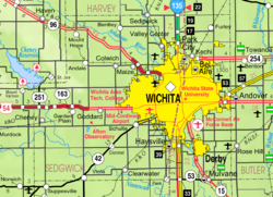
 Location within Sedgwick County and Kansas |
|
 KDOT map of Sedgwick County (legend) |
|
| Coordinates: 37°47′57″N 97°19′20″W / 37.79917°N 97.32222°WCoordinates: 37°47′57″N 97°19′20″W / 37.79917°N 97.32222°W | |
| Country | United States |
| State | Kansas |
| County | Sedgwick |
| Government | |
| • Mayor | Ray Mann |
| Area | |
| • Total | 9.51 sq mi (24.63 km2) |
| • Land | 9.49 sq mi (24.58 km2) |
| • Water | 0.02 sq mi (0.05 km2) |
| Elevation | 1,368 ft (417 m) |
| Population (2010) | |
| • Total | 7,297 |
| • Estimate (2015) | 7,618 |
| • Density | 770/sq mi (300/km2) |
| Time zone | Central (CST) (UTC-6) |
| • Summer (DST) | CDT (UTC-5) |
| ZIP codes | 67147, 67204, 67219 |
| Area code | 316 |
| FIPS code | 20-54450 |
| GNIS feature ID | 0473849 |
| Website | parkcityks.com |
Park City is a city in Sedgwick County, Kansas, United States, and a suburb of Wichita. As of the 2010 census, the city population was 7,297.
The first Park City was founded in 1870. Located 14 miles (23 km) to the northwest of Wichita, it was at first a formidable rival, but it risked all on the county seat, and lost. When the railroad passed it by and came to Wichita, the town died, and its houses were removed to Wichita, Newton and Hutchinson.
The current Park City began as the Park City Improvement District in 1953. The District grew from a quarter section of farmland purchased by developers into a 3,321-acre (13.44 km2) community. After the approval of the Sedgwick County Board of Commissioners, Park City became a third class city on November 26, 1980. The new city held a special election on February 17, 1981, in which Raymond J. Reiss was elected mayor along with five council members to form the first governing body.
Hartman Arena, a privately constructed and owned arena from local developer Wink Hartman, opened in March 2009 and serves as the home of the Wichita Wings indoor football team.
Park City is located at 37°47′57″N 97°19′20″W / 37.79917°N 97.32222°W (37.799119, -97.322110). According to the United States Census Bureau, the city has a total area of 9.51 square miles (24.63 km2), of which, 9.49 square miles (24.58 km2) is land and 0.02 square miles (0.05 km2) is water.
...
Wikipedia
