Paraty
| Paraty | |||
|---|---|---|---|

Paraty from the bay
|
|||
|
|||
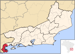
 Location in Rio de Janeiro state |
|||
| Country | Brazil | ||
| Region | Southeast | ||
| State | Rio de Janeiro | ||
| Government | |||
| • Mayor | Carlos José Gama Miranda | ||
| Area | |||
| • Total | 928.47 km2 (358.48 sq mi) | ||
| Elevation | 5 m (16 ft) | ||
| Population (2009) | |||
| • Total | 35,730 | ||
| Time zone | UTC-3 (UTC-3) | ||
| • Summer (DST) | UTC-2 (UTC-2) | ||
| Website | pmparaty.rj.gov.br paratyonline.com | ||
| Postal Code (CEP): 23970-000 | |||
Coordinates: 23°13′10″S 44°42′53″W / 23.21944°S 44.71472°W Paraty (or Parati, Portuguese pronunciation: [pɐɾɐˈtʃi]) is a preserved Portuguese colonial (1500–1822) and Brazilian Imperial (1822–1889) municipality with a population of about 36,000. It is located on the Costa Verde (Green Coast), a lush, green corridor that runs along the coastline of the state of Rio de Janeiro, in Brazil. Paraty has become a popular tourist destination in recent years, renowned for the historic town and the coast and mountains in the region.
The town is located on the Bay of Ilha Grande, which is dotted with many tropical islands. Rising up as high as 1,300 meters behind the town are tropical forests, mountains, and waterfalls. It is the southernmost and westernmost city in Rio de Janeiro state.
Paraty has great tourist appeal due to its natural beauty, and is listed by IPHAN a National Historic Landmark. More than 80% of its territory is protected by conservation units:
Nearby is the Serra do Mar State Park of São Paulo. The municipality also includes an indigenous village and an Afro-Brazilian quilombo settelement.
...
Wikipedia


