Pandoras Pass, New South Wales
| Pandoras Pass | |
|---|---|
| Brennans Gap; Pandora's Pass | |

Road sign on Pandoras Pass
|
|
| Elevation | 788 m (2,585 ft) |
| Traversed by | Rockgedgiel to Pandoras Road |
| Location | Coolah Tops National Park, New South Wales, Australia |
| Range | Warrumbungle Range, Great Dividing Range |
| Coordinates | 31°43′S 149°55′E / 31.717°S 149.917°ECoordinates: 31°43′S 149°55′E / 31.717°S 149.917°E |
| Topo map | Coolah 8834 |
|
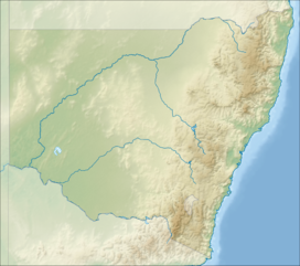
Location in New South Wales
|
|
The Pandoras Pass, also Brennans Gap and Pandora's Pass is a mountain pass across the Warrumbungle Range, a spur off the Great Dividing Range, located in the Coolah Tops National Park in northwestern New South Wales, Australia.
At an altitude of 788 metres (2,585 ft) above sea level, the pass provides a passage between Dunedoo and Coolah in the southwest and Premer and the Liverpool Plains in the north.
The area was first explored by Europeans in 1823 by the botanist and explorer Allan Cunningham. He discovered the pass on 9 June 1823 after searching for approximately 50 miles (80 km) from an easterly direction. The pass allowed an easy passage through the mountain range to the Liverpool Plains on the northern side of the mountain range. The exploration journey commenced from Bathurst in April 1823.
Today the pass is a lightly used gravel road with the main traffic through the mountain range passing through other routes, such as the New England Highway to the east and the Black Stump Way to the west.
After receiving Governor Brisbane's approval for the exploration Cunningham left Sydney on 31 March 1823, crossing the Nepean River on his way to Bathurst. Arriving at Bathurst he made final preparations for the journey and departed north on 15 April. He took with him five servants and "five strong packhorses" to carry their provisions. Cunninhams party passed through Dabee, now known as Rylstone, reaching the Goulburn River on 6 May 1823. Now the southern edge of the Liverpool Range was only 15 miles (24 km) to the north and he proceeded there. He reached Mount Macarthur (now Mount Moan) Cunningham now sought a passage through the range and decided to move east along the bottom of the range. After realising the range was becoming more difficult he "halted on the verge of a perpendicular ravine, being unable to advance another mile to the eastward by reason of the sharp water gullies between which lay steep ravines". He returned to Mount Moan, the fruitless journey east costing three weeks and three days. They proceeded north west again searching for a passage through the Liverpool Range. After a further six days Cunningham decided to mount the western range and take his bearings. The view he obtained filled him with delight; for, on looking round him and tracing the line of the main northern range, he saw a considerable depression in the range, and writes: "it was a very low back in the main ridge distant about 3 miles (4.8 km), and although limited, afforded me a clear view of the open plains north of this extensive barrier."
...
Wikipedia

