Palm Beach County, Florida
| Palm Beach County, Florida | |||
|---|---|---|---|

West Palm Beach, looking northeast
|
|||
|
|||
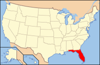
 Location in the U.S. state of Florida |
|||
 Florida's location in the U.S. |
|||
| Founded | April 30, 1909 | ||
| Named for | Palm Beach | ||
| Seat | West Palm Beach | ||
| Largest city | West Palm Beach | ||
| Area | |||
| • Total | 2,383 sq mi (6,172 km2) | ||
| • Land | 1,970 sq mi (5,102 km2) | ||
| • Water | 413 sq mi (1,070 km2), 17.3% | ||
| Population (est.) | |||
| • (2015) | 1,422,789 | ||
| • Density | 722/sq mi (279/km²) | ||
| Congressional districts | 18th, 20th, 21st, 22nd | ||
| Time zone | Eastern: UTC-5/-4 | ||
| Website | www |
||
Palm Beach County is a county located in the state of Florida, directly north of Broward County. As of the 2010 census, the population was 1,320,134, making it the third-most populous county in Florida. The largest city and county seat is West Palm Beach. Named after one of its oldest settlements, Palm Beach, the county was established in 1909, after being split from Dade County. The county's modern-day boundaries were established in 1963. Palm Beach County is one of the three counties in South Florida and is part of the Miami metropolitan area, which was home to an estimated 6,012,331 people at the 2015 census.
The area had been increasing in population since the late 19th century, with the incorporation of West Palm Beach in 1894 and after Henry Flagler extended the Florida East Coast Railway and built the Royal Poinciana Hotel, The Breakers, and Whitehall. In 1928, the Okeechobee hurricane struck West Palm Beach and caused thousands of deaths. Since then, a number of other tropical cyclones have impacted the area. More recently, the county acquired national attention during the 2000 presidential election, when a controversial recount occurred.
...
Wikipedia


