Palatka, FL Micropolitan Statistical Area
| Putnam County, Florida | ||
|---|---|---|

|
||
|
||
 Location in the U.S. state of Florida |
||
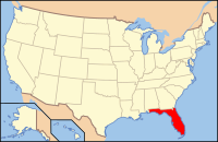
 Florida's location in the U.S. |
||
| Founded | January 18, 1849 | |
| Seat | Palatka | |
| Largest city | Palatka | |
| Area | ||
| • Total | 827 sq mi (2,142 km2) | |
| • Land | 728 sq mi (1,886 km2) | |
| • Water | 99 sq mi (256 km2), 12.0% | |
| Population (est.) | ||
| • (2015) | 72,023 | |
| • Density | 99/sq mi (38/km²) | |
| Congressional districts | 5th, 6th | |
| Time zone | Eastern: UTC-5/-4 | |
| Website | www |
|
Putnam County is a county located in the state of Florida. As of the 2010 census, the population was 74,364. Its county seat is Palatka.
Putnam County comprises the Palatka, FL Micropolitan Statistical Area, which is included in the Jacksonville-St. Marys-Palatka, FL-GA Combined Statistical Area. The county is centrally located between Jacksonville, Gainesville, St. Augustine, and Daytona Beach.
Putnam County was created in 1849. It was Florida's 28th county created from parts of St. Johns, Alachua, Orange, Duval, and Marion counties. The county was named for Benjamin A. Putnam, who was a soldier in the First Seminole War, a lawyer, Florida legislator, and the first president of the Florida Historical Society. The Putnam County Historical Society has determined that Benjamin A. Putnam is the grandson of Israel Putnam, for whom other counties and places in the United States are named. Benjamin A. Putnam died in the county seat of Palatka in 1869.
...
Wikipedia

