Palakkad
|
Palakkad പാലക്കാട് |
|
|---|---|
| City | |

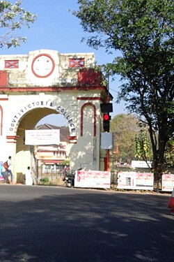
Govt Victoria College,Palakkad
|
|
| Coordinates: 10°46′12″N 76°39′00″E / 10.7700°N 76.6500°ECoordinates: 10°46′12″N 76°39′00″E / 10.7700°N 76.6500°E | |
| State | Kerala |
| District | Palakkad District |
| Government | |
| • Type | Municipality |
| • Body | Palakkad Municipality |
| • Municipal Chairperson | Prameela Sasidharan (BJP) |
| • District Collector | Mary Kutty issac IAS |
| Population (2011) | |
| • City | 130,955 |
| • Rank | 6 th |
| • Metro | 2,93,566 |
| Languages | |
| • Official | Malayalam, English |
| Time zone | IST (UTC+5:30) |
| PIN | 678001 |
| Telephone code | Palakkad: 91-(0)491 |
| Vehicle registration | KL-09 (Palakkad) KL-49 (Alathur) KL-50 (Mannarkkad) KL-51 (Ottappalam) KL-52 (Pattambi) KL-70 (Chittur) |
| Literacy | 94.20% |
Palakkad (Malayalam: പാലക്കാട്) ![]() pronunciation , also known as Palghat, is a city and municipality in the state of Kerala in southern India, spread over an area of 26.60 km2 and is the administrative headquarters of the Palakkad District. In earlier times, Palakkad was known as Palakkattussery. Palakkad is the seventh most populous town in Kerala and lies near the Palghat Gap. Malayalam is the generally spoken language in Palakkad. The city is situated about 350 kilometres (217 mi) north of state capital Thiruvananthapuram and 54 kilometers south west of Coimbatore, and 66 km north east of Thrissur on the Salem-Kanyakumari National Highway NH 47.
pronunciation , also known as Palghat, is a city and municipality in the state of Kerala in southern India, spread over an area of 26.60 km2 and is the administrative headquarters of the Palakkad District. In earlier times, Palakkad was known as Palakkattussery. Palakkad is the seventh most populous town in Kerala and lies near the Palghat Gap. Malayalam is the generally spoken language in Palakkad. The city is situated about 350 kilometres (217 mi) north of state capital Thiruvananthapuram and 54 kilometers south west of Coimbatore, and 66 km north east of Thrissur on the Salem-Kanyakumari National Highway NH 47.
The commonly held belief is that the name Palakkad is a fusion of two Malayalam words, Pala, which was the name given for barren land during the Sangam period, and Kadu, which means forest.
Palakkad is the gateway to Kerala due to the presence of the Palakkad Gap, in the Western Ghats. Malayalam is the generally spoken language in Palakkad as it is the official language. The town is blessed with many small and medium rivers, which are tributaries of the Bharathapuzha River. Of the number of dams in Palakkad district, the largest Malampuzha dam is 12 km from Palakkad town.
...
Wikipedia


