Pachmarhi
|
Pachmarhi पचमढी |
|
|---|---|
| Hill station | |

Pachmarhi valley
|
|
| Nickname(s): Queen of Satpura | |
| Coordinates: 22°28′00″N 78°26′00″E / 22.4667°N 78.4333°ECoordinates: 22°28′00″N 78°26′00″E / 22.4667°N 78.4333°E | |
| Country | India |
| State | Madhya Pradesh |
| District | Hoshangabad |
| Elevation | 1,100 m (3,600 ft) |
| Languages | |
| • Official | Hindi |
| Time zone | IST (UTC+5:30) |
| PIN | 461881 |
| Telephone code | 917578 |
| Vehicle registration | MP-05 |
| Nearest city | Pipariya |
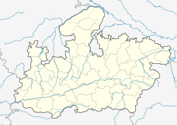
Pachmarhi is a hill station in Madhya Pradesh state of central India. It has been the location of a cantonment (Pachmarhi Cantonment) since British Raj. It is widely known as Satpura ki Rani ("Queen of Satpura"), situated at a height of 1100 m in a valley of the Satpura Range in Hoshangabad district. Dhupgarh, the highest point (1,350 m) in Madhya Pradesh and the Satpura range, is located here.
The name Pachmarhi is believed to be derived from the Hindi words Panch ("five") and Marhi ("caves"). According to a legend, these caves were built by five Pandava brothers of Mahabharatha era during their fourteen years of exile. The caves are situated on a hilltop and provide an excellent vantage point.
British arrival, Pachmarhi region came under the kingdom of the Gond king Bhawut Singh, although it was a populated village or town at that time. Captain James Forsyth of the British Army along with Subhedar Major Nathoo Ramji Powar who was later made the Kotwal (Incharge of the armoury (Koth)of Pachmarhi, spotted the plateau in the Pachmarhi region in 1857, while leading his troops on the way to Jhansi. It quickly developed into hill station and sanatorium for British troops in the Central Provinces of India.
The population in 1901 was 3,020, rising to double that number in the hot summer months. Pachmarhi also served as the summer capital for the Central Provinces.
...
Wikipedia


