Overmountain Victory National Historic Trail
| Overmountain Victory National Historic Trail | |
|---|---|

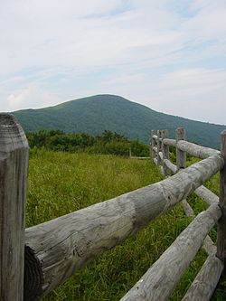
Roan Mountain, the trail's highest point.
|
|
| Length | 214 mi (344 km) |
| Location | Southeast United States |
| Designation | National Historic Trail (1980) |
| Trailheads |
Elizabethton, Tennessee Kings Mountain National Military Park |
| Use | Hiking, Motor Route, Historical Reenactment |
| Elevation | |
| Highest point | Roan Mountain |
| Lowest point | Watauga River |
| Hiking details | |
| Months | late September to mid October |
| Sights |
Blue Ridge Mountains Doe River Fort Watauga |
| Hazards | river crossing weather partial motor route |
| Website | Overmountain Victory National Historic Trail |
The Overmountain Victory National Historic Trail (OVHT) is part of the U.S. National Trails System. It recognizes the Revolutionary War Overmountain Men, Patriots from what is now East Tennessee who crossed the Great Smoky Mountains and then fought in the Battle of Kings Mountain in South Carolina.
The OVHT follows the route from Abingdon, Virginia at the Abingdon Muster Grounds, fording the Watauga River at Sycamore Shoals through present day Elizabethton, Tennessee, crossing the Doe River twice near both Hampton, Tennessee and Roan Mountain, Tennessee, and ascending over the steep Great Smoky Mountains of Tennessee and North Carolina, on through South Carolina to the site of the Battle of Kings Mountain now within Kings Mountain National Military Park. The trail network consists of a 330-mile (530 km) corridor, including a 70-mile (110 km) branch from Elkin, North Carolina, that joins the main route at Morganton, North Carolina. In Rutherford County, North Carolina, the trail follows the approximate location of Rock Road through the Gilbert Town Historic District.
...
Wikipedia
