Otari, Nagano
|
Otari 小谷村 |
|||
|---|---|---|---|
| Village | |||

Otari Village Hall
|
|||
|
|||
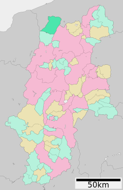
 Location of Otari in Nagano Prefecture |
|||
| Coordinates: 36°46′44.6″N 137°54′29.7″E / 36.779056°N 137.908250°ECoordinates: 36°46′44.6″N 137°54′29.7″E / 36.779056°N 137.908250°E | |||
| Country | Japan | ||
| Region | Chūbu (Kōshin'etsu) | ||
| Prefecture | Nagano | ||
| District | Kitaazumi | ||
| Area | |||
| • Total | 267.91 km2 (103.44 sq mi) | ||
| Population (October 2016) | |||
| • Total | 2,892 | ||
| • Density | 10.8/km2 (28/sq mi) | ||
| Time zone | Japan Standard Time (UTC+9) | ||
| Symbols | |||
| • Tree | Fagus crenata | ||
| • Flower | Prunus sargentii | ||
| Phone number | 0261-82-2001 | ||
| Address | 131 Nakaotari, Otari-mura, Kitaazumi-gun, Nagano-ken 399-9494 | ||
| Website | www |
||
Otari (小谷村 Otari-mura?) is a village located in Kitaazumi District in far northwest Nagano Prefecture, in the Chūbu region of Japan. As of 1 October 2016[update], the village had an estimated population of 2,982 and a population density of 10.8 persons per km². Its total area was 267.91 square kilometres (103.44 sq mi).
Otari is located in the mountainous far northwestern Nagano Prefecture, bordered nu Niigata Prefecture to the north and west. Much of the village is within the borders of the Chūbu-Sangaku National Park or the Myōkō-Togakushi Renzan National Park.
The area of present-day Otari was part of ancient Shinano Province and was part of the territory controlled by Matsumoto Domain under the Tokugawa shogunate of the Edo period. The modern village of Otari was established on April 1, 1954 by the merger of the villages of Minami-Otari, Kita-Otari and Nakatsuchi.
Otari has one public elementary school and one public middle school operated by the village government. The village does not have a high school.
...
Wikipedia


