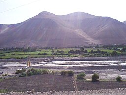
Osmore River
| Osmore River | |
|
Moquegua (Osmore) River Valley
|
|
| Country | Peru |
|---|---|
| State | Moquegua Region |
| Region | South America |
| Part of | Moquegua River |
| Source | Chuquiananta and Arundane Mountains |
| - location | Sierra, Peru |
| - elevation | 5,100 m (16,732 ft) |
| - coordinates | 16°52′00″S 70°26′00″W / 16.86667°S 70.43333°W |
| Mouth | Pacific Ocean |
| - location | Ilo, Coastal Pacific Ocean, Peru |
| - elevation | 0 m (0 ft) Pacific Ocean |
| - coordinates | 17°43′0″S 71°20′0″W / 17.71667°S 71.33333°WCoordinates: 17°43′0″S 71°20′0″W / 17.71667°S 71.33333°W |
| Length | 480 km (300 mi) approx. |
| Basin | 3,480 km2 (1,300 sq mi) approx. |
Osmore River (also Moquegua, Ilo, or Tumilaca) system flows northeast to southwest in the Moquegua Region of southern coastal Peru. The river has its origin in the snow peaks of the Chuqi Ananta and Arundane mountains, at an elevation of 5,100 metres (16,700 ft) (above sea level). It changes names as it descends from the Andes: From its origin it is called the Moquegua, then Osmore in the middle valley as Rio Coscori and Rio Tumilaca including where the river disappears into subterranean channels, and further down in the lower reaches as Rio Ilo.
An initial reconnaissance of the archaeological treasures of the valley carried out in the 1980s revealed more than 500 archeological sites dated from 10,000 years of human occupation. The Asana archaeological site, occupied over a period of 8,000 years, is located by the Asana River, a tributary of the Osmore.
There are also Wari culture sites, and the Tiwanaku culture sites in the area; this is where these two cultures came in contact.
The river basin is situated within Moquegua Region's Mariscal Nieto and Ilo provinces. It is geographically located between parallels 16 º 52 'and 17 º 43' south latitude and between the meridians 70 º 26 'and 71 ° 20' west longitude. The hydrographic system is part of the Pacific slope.
The river flows along a geological fault known as Cholo fault, and flows over a length of 480 kilometres (300 mi)draining an area of 1,343 square miles (3,480 km2) (of which 680 square kilometres (260 sq mi) are in a wet basin, located above 3,900 metres (12,800 ft)). It debouches in to the Pacific after dropping over a height of over 5,000 metres (16,000 ft) in its short stretch of 480 kilometres (300 mi) from the source and thus having a river gradient of 3.6% (close to a highway gradient). It has several tributaries which have their origin in the western cordillera.
The river basin is bounded on the north by the Tambo River basin, which is a sub-basin of the Vizcachas River; on the east and south, with the Locumba River basin; and on the west by the Pacific Ocean and the region between Moquegua and Tambo, formed by a series of short and medium streams.
...
Wikipedia

