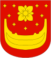
Os, Hordaland
| Os kommune | |||
|---|---|---|---|
| Municipality | |||

View of Osøyro
|
|||
|
|||
 Os within Hordaland |
|||
| Coordinates: 60°13′37″N 05°28′33″E / 60.22694°N 5.47583°ECoordinates: 60°13′37″N 05°28′33″E / 60.22694°N 5.47583°E | |||
| Country | Norway | ||
| County | Hordaland | ||
| District | Midhordland | ||
| Administrative centre | Osøyro | ||
| Government | |||
| • Mayor (1999) | Terje Søviknes (FrP) | ||
| Area | |||
| • Total | 139.56 km2 (53.88 sq mi) | ||
| • Land | 133.47 km2 (51.53 sq mi) | ||
| • Water | 6.09 km2 (2.35 sq mi) | ||
| Area rank | 362 in Norway | ||
| Population (2014) | |||
| • Total | 18,678 | ||
| • Rank | 59 in Norway | ||
| • Density | 139.9/km2 (362/sq mi) | ||
| • Change (10 years) | 27.8 % | ||
| Demonym(s) | Osing | ||
| Time zone | CET (UTC+1) | ||
| • Summer (DST) | CEST (UTC+2) | ||
| ISO 3166 code | NO-1243 | ||
| Official language form | Nynorsk | ||
| Website | www |
||
|
|
|||
Os is a municipality in Hordaland county, Norway. It is located in the Midhordland region, just south of Norway's second-largest city, Bergen. Due to its proximity to Bergen, Os is experiencing strong population growth. The administrative centre (and commercial centre) of Os is the village of Osøyro. It is the largest settlement in the municipality, with over 60% of the municipal residents living here. Other large villages in Os include Hagavik, Halhjem, Søfteland, Søre Øyane, and Søvik.
The parish of Os was established as a formannskapsdistrikt, the predecessor of today's municipalities, on 1 January 1838. It originally encompassed all of the land surrounding the Fusafjorden. In 1856, the eastern district of Os (across the fjord) was separated to form the new, separate municipality of Fusa. This left Os with 3,750 residents.
In 1900 "Askviknes Barnehjem" (near Hagavik) opened; it housed children of romani/tater; in the beginning the children's stay was something their families applied for; later children were introduced to the facility without consent of their families.
On 1 January 1907, the northern part of the municipality was separated to form the new municipality of Samnanger. This left Os with 3,188 residents. On 1 January 1964, the Bogstrand area of Fusa (population: 28) was transferred to Os. This was the only part of Fusa on the west side of the fjord. The borders of Os have not changed since that time.
During World War II, the Ulven concentration camp was used by the occupying Nazi German Army. It was located just northwest of Osøyro.
...
Wikipedia


