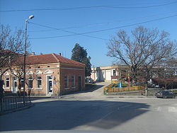
Oryahovo
|
Oryahovo Оряхово |
|
|---|---|
 |
|
| Location of Oryahovo | |
| Coordinates: 43°44′N 23°58′E / 43.733°N 23.967°ECoordinates: 43°44′N 23°58′E / 43.733°N 23.967°E | |
| Country | Bulgaria |
|
Province (Oblast) |
Vratsa |
| Government | |
| • Mayor | Hristo Ivanov (BSP) |
| Elevation | 173 m (568 ft) |
| Population (31.12.2009) | |
| • Total | 5,400 |
| Time zone | EET (UTC+2) |
| • Summer (DST) | EEST (UTC+3) |
| Postal Code | 3300 |
| Area code(s) | 09171 |
Oryahovo (Bulgarian: Оряхово) is a port city in northwestern Bulgaria, part of Vratsa Province. It is located in a hilly country on the right bank of the Danube, just east of the mouth of the river Ogosta, a few more kilometres downstream from where the Jiu flows into the Danube on Romanian territory. The town is known for the ferry service that connects it to the Romanian town of Bechet across the river. There are also plans by local private companies for a bridge across the Danube. As of December 2009, Oryahovo has a population of 5,400 inhabitants.
The town's name has evolved through the course of history, with names such as Vrhov, Orezov, Oreov and Rahovo being mentioned in documents until the current one was officially established in 1886. The area around Oryahovo has been inhabited since ancient times, as archaeological research has proven with findings from the early Neolithic to the Late Middle Ages. A fortress called Kamaka (Камъка) is located 1 km east from Oryahovo, which existed from the 9th to the 14th century. In 1396, the city, already controlled by the Ottoman Turks, was sacked and its Ottoman civilian inhabitants killed while the prisoners massacred by French crusaders heading towards Nicopolis. The troops of Holy Roman Emperor Sigismund and Polish King Władysław III of Varna passed through the fortress during their unsuccessful crusades (the Battle of Nicopolis in 1396 and the Battle of Varna in 1444, respectively) against the Ottoman Empire.
...
Wikipedia

