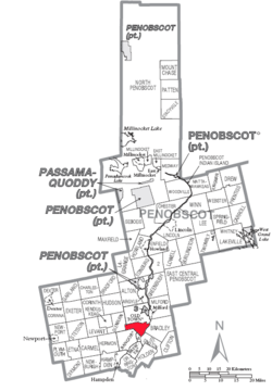
Orono, ME
| Town of Orono | ||
|---|---|---|
| Town | ||

Mill Street business in downtown Orono
|
||
|
||
 |
||
| Coordinates: 44°52′59″N 68°40′19″W / 44.883°N 68.672°WCoordinates: 44°52′59″N 68°40′19″W / 44.883°N 68.672°W | ||
| Country | United States | |
| State | Maine | |
| County | Penobscot | |
| Settled | 1774 | |
| Incorporated | March 12, 1806 | |
| Chartered | 1969 | |
| Government | ||
| • Type | Council/Manager | |
| • Town Manager | Sophia L. Wilson | |
| Area | ||
| • Total | 19.60 sq mi (50.76 km2) | |
| • Land | 18.19 sq mi (47.11 km2) | |
| • Water | 1.41 sq mi (3.65 km2) 7.19% | |
| Population (2010) | ||
| • Total | 10,362 | |
| • Estimate (2012) | 10,585 | |
| • Density | 569.7/sq mi (220.0/km2) | |
| Time zone | EST (UTC-5) | |
| • Summer (DST) | EDT (UTC-4) | |
| ZIP Code | 04473-Town, 04469-UMaine | |
| Area code(s) | 207 | |
| Website | www.orono.org | |
Orono (/ˈɒrənoʊ/) is a town in Penobscot County, Maine, United States. Located on the Penobscot and Still Water Rivers, it was first settled by Europeans in 1774 and named in honor of Chief Joseph Orono, a sachem of the Penobscot nation. It is home to the University of Maine. The town's population was 10,362 at the 2010 census.
According to the United States Census Bureau, the town has a total area of 19.60 square miles (50.76 km2), of which, 18.19 square miles (47.11 km2) of it is land and 1.41 square miles (3.65 km2) is water. The town is divided by the Stillwater River, a branch of the Penobscot River. It occupies part of Marsh Island, which is surrounded by the Penobscot and the Stillwater, and the remainder of the town is on the mainland. The Orono Dam impounds the Stillwater River at its confluence with the Penobscot River near downtown Orono.
This climatic region is typified by large seasonal temperature differences, with warm to hot (and often humid) summers and cold (sometimes severely cold) winters. According to the Köppen Climate Classification system, Orono has a humid continental climate, abbreviated "Dfb" on climate maps.
...
Wikipedia

