Orinda Film Festival
| City of Orinda | |
|---|---|
| City | |

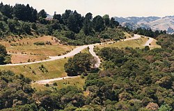
The hills of Orinda
|
|
 Location in Contra Costa County and the state of California |
|
| Location in the United States | |
| Coordinates: 37°52′58″N 122°10′47″W / 37.88278°N 122.17972°WCoordinates: 37°52′58″N 122°10′47″W / 37.88278°N 122.17972°W | |
| Country | United States |
| State | California |
| County | Contra Costa |
| Incorporated | July 1, 1985 |
| Government | |
| • Mayor | Dean Orr |
| • State Senator | Steve Glazer (D) |
| • State Assembly | Catharine Baker (R) |
| • U. S. Congress | Mark DeSaulnier (D) |
| Area | |
| • Total | 12.87 sq mi (33.33 km2) |
| • Land | 12.85 sq mi (33.29 km2) |
| • Water | 0.01 sq mi (0.04 km2) 0.12% |
| Elevation | 495 ft (151 m) |
| Population (2010) | |
| • Total | 17,643 |
| • Estimate (2016) | 19,470 |
| • Density | 1,514.82/sq mi (584.86/km2) |
| Time zone | PST (UTC-8) |
| • Summer (DST) | PDT (UTC-7) |
| ZIP code | 94563 |
| Area code(s) | 925 |
| FIPS code | 06-54232 |
| GNIS feature IDs | 1659313, 2411334 |
| Website | www |
| Orinda, California | ||||||||||||||||||||||||||||||||||||||||||||||||||||||||||||
|---|---|---|---|---|---|---|---|---|---|---|---|---|---|---|---|---|---|---|---|---|---|---|---|---|---|---|---|---|---|---|---|---|---|---|---|---|---|---|---|---|---|---|---|---|---|---|---|---|---|---|---|---|---|---|---|---|---|---|---|---|
| Climate chart () | ||||||||||||||||||||||||||||||||||||||||||||||||||||||||||||
|
||||||||||||||||||||||||||||||||||||||||||||||||||||||||||||
|
||||||||||||||||||||||||||||||||||||||||||||||||||||||||||||
| J | F | M | A | M | J | J | A | S | O | N | D |
|
6
54
34
|
4.9
59
37
|
4.3
61
38
|
2.2
68
42
|
1.2
71
46
|
0.2
77
49
|
0
82
52
|
0.1
81
51
|
0.4
83
50
|
1.9
75
44
|
3.2
65
38
|
6.2
56
36
|
| Average max. and min. temperatures in °F | |||||||||||
| Precipitation totals in inches | |||||||||||
| Metric conversion | |||||||||||
|---|---|---|---|---|---|---|---|---|---|---|---|
| J | F | M | A | M | J | J | A | S | O | N | D |
|
152
12
1
|
123
15
3
|
109
16
4
|
55
20
5
|
31
22
8
|
4.6
25
10
|
...
| |||||

