Oregon Caves National Monument
| Oregon Caves National Monument and Preserve | |
| U.S. National Monument | |
|
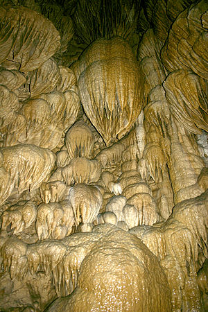
Formations resembling drapery in a dome-shaped pit in Oregon Caves
|
|
| Country | United States |
|---|---|
| State | Oregon |
| County | Josephine |
| City | Cave Junction |
| Cave entrance | About 20 miles (32 km) east of Cave Junction |
| - elevation | 4,377 ft (1,334 m) |
| - coordinates | 42°05′44″N 123°24′21″W / 42.09556°N 123.40583°WCoordinates: 42°05′44″N 123°24′21″W / 42.09556°N 123.40583°W |
| Highest point | |
| - elevation | 6,390 ft (1,948 m) |
| Lowest point | |
| - elevation | 3,680 ft (1,122 m) |
| Area | 4,554 acres (1,843 ha) |
| Geology | Solutional cave in marble |
| Established | July 12, 1909 |
| Management | National Park Service |
| Visitation | 80,613 in 2016 |
|
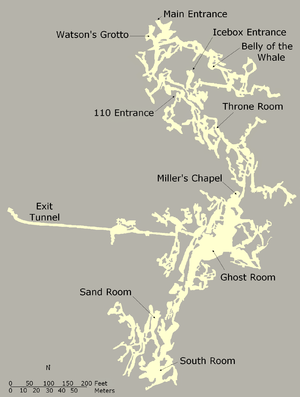
Map of the cave
|
|
| Website: Oregon Caves National Monument and Preserve | |
Oregon Caves National Monument and Preserve is a protected area in the northern Siskiyou Mountains of southwestern Oregon in the United States. The 4,554-acre (1,843 ha) park, including the marble cave, is 20 miles (32 km) east of Cave Junction, on Oregon Route 46. The protected area, managed by the National Park Service (NPS), is in southwestern Josephine County, near the Oregon–California border.
Elijah Davidson, a resident of nearby Williams, discovered the cave in 1874. Over the next two decades, private investors failed in efforts to run successful tourist ventures at the publicly owned site. After passage of the Antiquities Act by the United States Congress, in 1909 President William Howard Taft established Oregon Caves National Monument, to be managed by the United States Forest Service (USFS). The growing popularity of the automobile, construction of paved highways, and promotion of tourism by boosters from Grants Pass led to large increases in cave visitation during the late 1920s and thereafter. Among the attractions at the remote monument is the Oregon Caves Chateau, a six-story hotel built in a rustic style in 1934. It is a National Historic Landmark and is part of the Oregon Caves Historic District within the monument. The NPS, which assumed control of the monument in 1933, offers tours of the cave from mid-April through early November. In 2014, the protected area was expanded by about 4,000 acres (1,600 ha) and re-designated a National Monument and Preserve. At the same time, the segment of the creek that flows through the cave was re-named for the mythological Styx and added to the National Wild and Scenic Rivers System.
...
Wikipedia


