Orangeburg County
| Orangeburg County, South Carolina | |
|---|---|
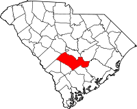
 Location in the U.S. state of South Carolina |
|
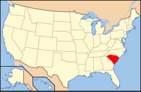
 South Carolina's location in the U.S. |
|
| Founded | 1769 |
| Named for | William V, Prince of Orange |
| Seat | Orangeburg |
| Largest city | Orangeburg |
| Area | |
| • Total | 1,128 sq mi (2,922 km2) |
| • Land | 1,106 sq mi (2,865 km2) |
| • Water | 22 sq mi (57 km2), 1.9% |
| Population (est.) | |
| • (2015) | 122,980 |
| • Density | 84/sq mi (32/km²) |
| Congressional districts | 2nd, 6th |
| Time zone | Eastern: UTC-5/-4 |
| Website | www |
Orangeburg County is a county located in the U.S. state of South Carolina. As of the 2010 census, the population was 92,501. Its county seat is Orangeburg. The county was created in 1769.
Orangeburg County comprises the Orangeburg, SC Micropolitan Statistical Area, which is also included in the Columbia-Orangeburg-Newberry, SC Combined Statistical Area. It is located in the Midlands region of South Carolina.
It is home to Claflin University, a private college located in Orangeburg that is the oldest historically black college or university (HBCU) in the state. It is also the location of South Carolina State University, the only public four-year HBCU in the state.
The district was occupied for thousands of years by succeeding cultures of indigenous peoples. By the time of European encounter, Siouan-speaking tribes, such as the Pee Dee, Cheraw and Catawba, inhabited the Piedmont area above the fall line.
The Orangeburg Judicial District was chartered by European Americans in 1769 from a mostly unorganized upland area between the Congaree and Savannah rivers. A county, initially of the same name but later called Orange, was organized within the district but deorganized in 1791, after the American Revolutionary War.
...
Wikipedia
