Ooststellingwerf
| Ooststellingwerf | |||
|---|---|---|---|
| Municipality | |||

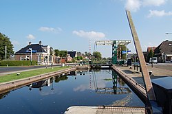
Lock in canal through Appelscha
|
|||
|
|||
 Location in Friesland |
|||
| Coordinates: 53°0′N 6°18′E / 53.000°N 6.300°ECoordinates: 53°0′N 6°18′E / 53.000°N 6.300°E | |||
| Country | Netherlands | ||
| Province | Friesland | ||
| Government | |||
| • Body | Municipal council | ||
| • Mayor | Harry Oosterman (CDA) | ||
| Area | |||
| • Total | 226.11 km2 (87.30 sq mi) | ||
| • Land | 224.16 km2 (86.55 sq mi) | ||
| • Water | 1.95 km2 (0.75 sq mi) | ||
| Elevation | 7 m (23 ft) | ||
| Population (February 2017) | |||
| • Total | 25,696 | ||
| • Density | 115/km2 (300/sq mi) | ||
| Time zone | CET (UTC+1) | ||
| • Summer (DST) | CEST (UTC+2) | ||
| Postcode | 8420–8435 | ||
| Area code | 0516 | ||
| Website | www |
||
Ooststellingwerf [ˈoːststɛlɪŋˌʋɛr(ə)f] is a municipality in the province of Friesland in the northern Netherlands. It is one of the municipalities of Friesland where the spoken language is not West Frisian; instead, Stellingwerfs, a dialect of Dutch Low Saxon, is spoken here.
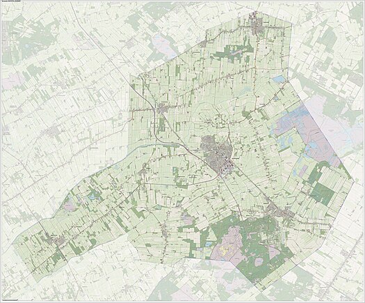
Dutch Topographic map of the municipality of Ooststellingwerf, June 2015
...
Wikipedia


