Onancock, Virginia
| Onancock, Virginia | |
|---|---|
| Town | |
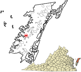
 Location in Accomack County and the state of Virginia. |
|
| Coordinates: 37°42′38″N 75°44′47″W / 37.71056°N 75.74639°WCoordinates: 37°42′38″N 75°44′47″W / 37.71056°N 75.74639°W | |
| Country | United States |
| State | Virginia |
| County | Accomack |
| Area | |
| • Total | 1.1 sq mi (2.7 km2) |
| • Land | 1.1 sq mi (2.7 km2) |
| • Water | 0.0 sq mi (0.0 km2) |
| Elevation | 13 ft (4 m) |
| Population (2010) | |
| • Total | 1,263 |
| • Density | 1,100/sq mi (470/km2) |
| Time zone | Eastern (EST) (UTC-5) |
| • Summer (DST) | EDT (UTC-4) |
| ZIP code | 23417 |
| Area code(s) | 757 |
| FIPS code | 51-59336 |
| GNIS feature ID | 1493376 |
Onancock is a town in Accomack County, Virginia, United States. The population was 1,263 at the 2010 census.
The Onancock Historic District, Cokesbury Church, Hopkins and Brother Store, and Kerr Place are listed on the National Register of Historic Places.
In the mid-19th century, it was a point along the stagecoach route between Wilmington, Delaware and Eastville, Virginia.
Onancock is located at 37°42′38″N 75°44′47″W / 37.71056°N 75.74639°W (37.710578, -75.746307).
According to the United States Census Bureau, the town has a total area of 1.0 square miles (2.7 km²), all of it land.
As of the census of 2000, there were 1,525 people, 656 households, and 392 families residing in the town. The population density was 1,452.3 people per square mile (560.8/km²). There were 733 housing units at an average density of 698.0 per square mile (269.5/km²). The racial makeup of the town was 66.43% White, 31.41% African American, 0.46% Native American, 0.07% Asian, 0.66% from other races, and 0.98% from two or more races. Hispanic or Latino of any race were 2.89% of the population.
...
Wikipedia
