Omemee, North Dakota
| Omemee, North Dakota | |
|---|---|
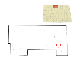
 Location of Omemee, North Dakota |
|
| Coordinates: 48°42′23″N 100°21′18″W / 48.70639°N 100.35500°WCoordinates: 48°42′23″N 100°21′18″W / 48.70639°N 100.35500°W | |
| Country | United States |
| State | North Dakota |
| County | Bottineau County |
| Township | Willow Vale |
| Legislative district | 6th |
| Founded | 1887 |
| Incorporated | 1902 |
| Disincorporated | ca. 1990 |
| Elevation | 1,512 ft (461 m) |
| Time zone | Central (CST) (UTC-6) |
| • Summer (DST) | CDT (UTC-5) |
| Area code(s) | 701 |
| FIPS code | 38-59420 |
| GNIS feature ID | 1030570 |
Omemee is a ghost town in Bottineau County in the U.S. State of North Dakota. It was a railroad hub in the early 1910s, located at the junction of two major railroads, the Soo Line Railroad and the Great Northern Railway. Incorporated as a city in 1902, Omemee has been abandoned since 2003.
Omemee was founded in 1887 in Willow Vale Township. It is named after Omemee, Ontario, in Canada, which was the hometown of Omemee's first post master. Omemee itself is an alternate spelling of the Ojibwe word omimi, meaning "dove." The post office opened in 1890 and closed in 1967, with mail service transferring to nearby Willow City. The town was incorporated in 1902 and was moved slightly in 1903 to the junction of the Great Northern Railway and the Soo Line Railway in 1903. Omemee disincorporated as a city prior to the 1990 Census. It currently has no population.
A 1906 review by the North Dakota Department of Agriculture and Labor indicated Omemee was the fourth largest town in Bottineau County. However, by the time it was founded, the cities of Bottineau and Willow City had grown to dominate trade in the region. Omemee, located between both towns was at a disadvantage, since many farmers had grown accustomed to doing business in those towns. Many predicted its status as a hub between two railroads would lead to substantial growth, making Omemee the railroad center of Bottineau County.
...
Wikipedia
