Omarska
|
Omarska Омарска |
|
|---|---|
| Town | |

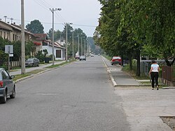
Main street
|
|
| Coordinates: 44°53′30″N 16°53′57″E / 44.89167°N 16.89917°ECoordinates: 44°53′30″N 16°53′57″E / 44.89167°N 16.89917°E | |
| Country |
|
| Entity | Republika Srpska |
| Municipality | Prijedor |
| Time zone | CET (UTC+1) |
| • Summer (DST) | CEST (UTC+2) |
Omarska (Cyrillic: Омарска) is a small town near Prijedor in northwestern Bosnia and Herzegovina. It includes an old iron mine and ore processing plant. During the Bosnian War it was the site of the Omarska concentration camp.
During World War II, a massacre of Bosnian Serb civilians occurred in Omarska.
The Omarska camp was a concentration camp run by Bosnian Serb forces in Omarska, set up for Bosniak and Croat men and women during the Prijedor massacre. Functioning in the first months of the Bosnian War in 1992, it was one of 677 alleged detention centers and camps set up throughout Bosnia and Herzegovina during the war. While nominally an "investigation center" or "assembly point" for members of the non-Serb population,Human Rights Watch classified Omarska as a concentration camp.
Municipal commonwealth of Omarska consists of Omarska town and 10 villages: Petrov Gaj, Kevljani, Lamovita, Bistrica, Verići, Niševići, Gradina, Jelićka, Krivaja and Marićka. Its geographical coordinates are 44°53'22.00"N 16°53'43.23"E. It has area of 246.73 km² and it is located 169m above sea level. Average temperature (over the year) is +12 degrees celsius. Average yearly rain level is 1200mm. Terrain of Omarska is mainly plains, 65% lowlands and 35% highlands.
River system in Omarska is very rich. Through the middle of Omarska territory runs river Gomjenica, which has great agricultural significance, because it runs through most fertile land in this area. Gomjenica is confluent of Sana. It infuses Sana in Prijedor.
...
Wikipedia

