Old Fordham Village
| Fordham | |
|---|---|
| Neighborhood of The Bronx | |

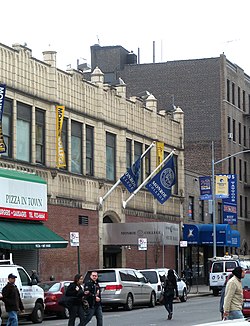
Looking south across Fordham Road and along Walton Avenue at Monroe College
|
|
| Coordinates: 40°51′33″N 73°53′54″W / 40.8592667°N 73.8984694°WCoordinates: 40°51′33″N 73°53′54″W / 40.8592667°N 73.8984694°W | |
| Country |
|
| State |
|
| City |
|
| Borough |
|
| Community District | The Bronx 5 and The Bronx 7 |
| Area | |
| • Total | 1.31 km2 (0.507 sq mi) |
| Population (2011) | |
| • Total | 43,394 |
| • Density | 33,000/km2 (86,000/sq mi) |
| Economics | |
| • Median income | $26,143 |
| ZIP codes | 10453, 10457, 10458, 10468 |
| Area code | 718, 347, 929, and 917 |
| Website | fordham |
Fordham is a group of neighborhoods located in the western Bronx, New York City. These neighborhoods are part of Bronx Community Board 5 and Bronx Community Board 7. Fordham is roughly bordered by Fordham Road to the north, Southern Boulevard to the east, East 183rd Street to the south, and Jerome Avenue to the west. The neighborhood's primary thoroughfare is Fordham Road; its main subway line is the IND Concourse Line (B and D trains), operating under the Grand Concourse, with the IRT Jerome Avenue Line (4 train) on its western border. ZIP codes include 10453, 10457, 10458 and 10468.
Fordham has a population of around 43,394 people. Its first growth was in the 1920s, when middle-class and working-class families from Manhattan flocked into the area, attracted by the then-modern housing and convenient subway access by Concourse, Jerome Avenue, and Third/Webster Avenues lines to business districts in Manhattan where they could work and shop. It is now predominately Latin American and African American. There is a significant historic Italian and Albanian population as well.
...
Wikipedia


