Okinawa City
|
Okinawa 沖縄市 Uchinaa |
||
|---|---|---|
| City | ||
 |
||
|
||
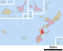
 Location of Okinawa in Okinawa Prefecture |
||
| Location of Okinawa in Okinawa Prefecture | ||
| Coordinates: 26°20′3″N 127°48′20″E / 26.33417°N 127.80556°ECoordinates: 26°20′3″N 127°48′20″E / 26.33417°N 127.80556°E | ||
| Country | Japan | |
| Region | Kyushu | |
| Prefecture | Okinawa Prefecture | |
| Government | ||
| • Mayor | Kita Kurose | |
| Area | ||
| • Total | 49.00 km2 (18.92 sq mi) | |
| Population (December, 2012) | ||
| • Total | 138,431 | |
| • Density | 2,625.12/km2 (6,799.0/sq mi) | |
| Time zone | Japan Standard Time (UTC+9) | |
| - Tree | Chinese Fan Palm (Livistona chinensis) | |
| - Flower | Hibiscus | |
| Phone number | 098-939-1212 | |
| Address | 26-1 Nakasonechō, Okinawa-shi 904-8501 | |
| Website |
www |
|
Okinawa (沖縄市 Okinawa-shi?, Okinawan: Uchinaa) is the second-largest city in Okinawa Prefecture, Japan, following Naha, the capital city. It is located in the central part of the island of Okinawa, about 20 kilometres (12 mi) north of Naha.
As of December 2012, the city has an estimated population of 138,431 and a population density of 2,625.12 persons per km². The total area is 49.00 km².
Under the Ryukyu Kingdom the present-day area of Okinawa City was occupied by two magiri, a type of administrative district. The Goeku magiri occupied the south of the city, and the north of the city was part of the Misato magiri.
In 1908, Okinawa Prefecture ended the magiri system and established the villages of Goeku and Misato. Both villages were agricultural and lacked urbanized areas prior to World War II.
After the Battle of Okinawa the United States established the first refugee camp in Okinawa in the area south of present-day Kadena Air Base. The population of the former villages swelled rapidly. An area of Goeku, called Goya (ごや), was mispronounced by Americans as Koza (コザ). During the occupation of Okinawa, the U.S. military government established the city of Koza (コザ市 Koza-shi?) in Goeku. Koza was the first city to use the katakana syllabary for its name. Misato merged into a neighboring community, and in 1946, again became separate, as did Goeku. Both municipalities, which were formerly largely agricultural, became heavily urbanized as a result of the construction of refugee camps and the establishment of large-scale military bases. The area became a "base city" catering to United States military personnel. On June 13, 1956, Goeku changed its name to the village of Koza; on July 1 of the same year it became a city.
...
Wikipedia


