Oisterwijk
| Oisterwijk | |||
|---|---|---|---|
| Municipality | |||

Gazebo in Oisterwijk
|
|||
|
|||
 Location in North Brabant |
|||
| Coordinates: 51°35′N 5°12′E / 51.583°N 5.200°ECoordinates: 51°35′N 5°12′E / 51.583°N 5.200°E | |||
| Country | Netherlands | ||
| Province | North Brabant | ||
| Government | |||
| • Body | Municipal council | ||
| • Mayor | Hans Janssen (CDA) | ||
| Area | |||
| • Total | 65.13 km2 (25.15 sq mi) | ||
| • Land | 63.93 km2 (24.68 sq mi) | ||
| • Water | 1.20 km2 (0.46 sq mi) | ||
| Elevation | 10 m (30 ft) | ||
| Population (February 2017) | |||
| • Total | 25,780 | ||
| • Density | 403/km2 (1,040/sq mi) | ||
| Demonym(s) | Oisterwijker | ||
| Time zone | CET (UTC+1) | ||
| • Summer (DST) | CEST (UTC+2) | ||
| Postcode | 5059–5066 | ||
| Area code | 013 | ||
| Website | oisterwijk |
||
Oisterwijk (Dutch pronunciation: [ˈoːstərˌʋɛik]) is a municipality and a city in the South of the Netherlands.
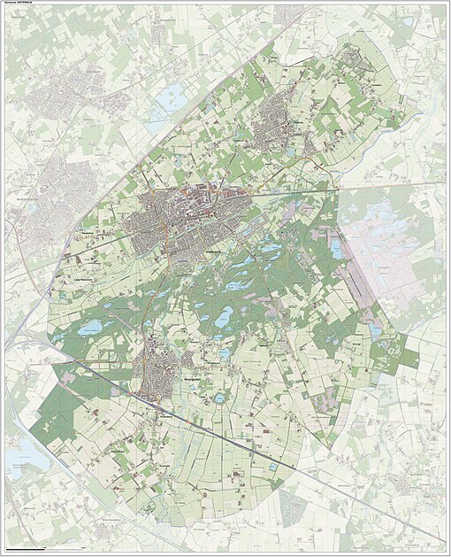
Dutch Topographic map of the municipality of Oisterwijk, June 2015
Oisterwijk received city rights in 1230. Part of the municipality of Oisterwijk includes the 'Oisterwijkse bossen en vennen' (Oisterwijk forests and fens) and the 'Kampina'. Both are nature reserves of outstanding natural beauty. The reserves are owned and kept by the 'Vereniging Natuurmonumenten' (Nature Monuments Society).
...
Wikipedia


