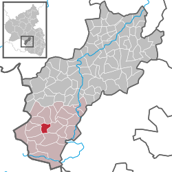
Ohmbach
| Ohmbach | ||
|---|---|---|
|
||
| Coordinates: 49°26′58.3″N 7°21′0.709″E / 49.449528°N 7.35019694°ECoordinates: 49°26′58.3″N 7°21′0.709″E / 49.449528°N 7.35019694°E | ||
| Country | Germany | |
| State | Rhineland-Palatinate | |
| District | Kusel | |
| Municipal assoc. | Oberes Glantal | |
| Government | ||
| • Mayor | Jochen Mayer (CDU) | |
| Area | ||
| • Total | 3.90 km2 (1.51 sq mi) | |
| Elevation | 313 m (1,027 ft) | |
| Population (2015-12-31) | ||
| • Total | 816 | |
| • Density | 210/km2 (540/sq mi) | |
| Time zone | CET/CEST (UTC+1/+2) | |
| Postal codes | 66903 | |
| Dialling codes | 06386 | |
| Vehicle registration | KUS | |
| Website | www.ohmbach.de | |
Ohmbach is an Ortsgemeinde – a municipality belonging to a Verbandsgemeinde, a kind of collective municipality – in the Kusel district in Rhineland-Palatinate, Germany. It belongs to the Verbandsgemeinde of Oberes Glantal, whose seat is in Schönenberg-Kübelberg.
Ohmbach stretches along the middle Ohmbach valley in the Western Palatinate between Herschweiler-Pettersheim and Brücken. Two brooks, one each side of the Ohmbach, empty into this river here. One of these, the Weitersbach, which flows from the east and also rises within Ohmbach’s limits, runs through a valley that has also been built up. The mountains on the valleys’ sides reach heights of well over 300 m above sea level, with the highest being the Knechtsberg (387 m). The municipal area measures 390 ha, of which 58 ha is wooded.
Ohmbach borders in the northeast on the municipality of Herschweiler-Pettersheim, in the east on the municipality of Steinbach am Glan, in the south on the municipality of Brücken, in the southwest on the municipality of Dittweiler, in the west on the municipality of Altenkirchen and in the northwest on the municipality of Krottelbach. Ohmbach also meets the municipality of Frohnhofen at a single point in the northwest.
Today’s village of Ohmbach grew out of two original centres bearing the names Ober-Ohmbach and Nieder-Ohmbach (“Upper” and “Nether” Ohmbach), the latter of which was originally named Weitersbach. Ober-Ohmbach’s houses clustered around a mediaeval church in the middle of a graveyard that stood on a mountain spur, while Nieder-Ohmbach stretched out on a hill south of the Weitersbach. The two villages on each side of the through road on the brook’s right bank long ago grew together. A newer residential area with a big new building zone with a fire station, a kindergarten and a playground stretches beneath a mountain slope on the Ohmbach’s left bank. Here, too, stands the Catholic church, built in 1970 (the mediaeval one is today Evangelical). The sporting ground with its clubhouse likewise lies on the Ohmbach’s left bank on Sportplatzstraße (“Sporting Ground Street”). The village owns two graveyards, the one in Ober-Ohmbach with its mortuary lies in the north end on Friedhofstraße (“Graveyard Street”), and the one in Nieder-Ohmbach is to be found on the through road south of the village.
...
Wikipedia


