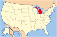
Ogemaw County, Michigan
| Ogemaw County, Michigan | |
|---|---|
 Location in the U.S. state of Michigan |
|
 Michigan's location in the U.S. |
|
| Founded | 1875 |
| Seat | West Branch |
| Largest city | West Branch |
| Area | |
| • Total | 575 sq mi (1,489 km2) |
| • Land | 563 sq mi (1,458 km2) |
| • Water | 11 sq mi (28 km2), 2.0% |
| Population | |
| • (2010) | 21,699 |
| • Density | 39/sq mi (15/km²) |
| Congressional district | 4th |
| Time zone | Eastern: UTC-5/-4 |
| Website | www |
Ogemaw County is a county located in the U.S. state of Michigan. As of the 2010 census, the population was 21,699. The county seat is West Branch.
The county newspaper of record is the Ogemaw Herald.
The county was originally created in 1840, but was absorbed into Iosco County in 1867. It was later recreated in 1873 and finally organized in 1875. The county's name is an Anglicization of the Anishinaabemowin word ogimaa, meaning "chief".
According to the U.S. Census Bureau, the county has a total area of 575 square miles (1,490 km2), of which 563 square miles (1,460 km2) is land and 11 square miles (28 km2) (2.0%) is water. Ogemaw County is considered to be part of Northern Michigan
As of the census of 2000, there were 21,645 people, 8,842 households, and 6,189 families residing in the county. The population density was 38 people per square mile (15/km²). There were 15,404 housing units at an average density of 27 per square mile (11/km²). The racial makeup of the county was 97.48% White, 0.13% Black or African American, 0.60% Native American, 0.38% Asian, 0.03% Pacific Islander, 0.13% from other races, and 1.25% from two or more races. 1.16% of the population were Hispanic or Latino of any race. 28.7% were of German, 12.3% American, 10.2% English, 9.2% Irish, 7.0% French and 6.7% Polish ancestry according to Census 2000. 97.9% spoke only English at home.
...
Wikipedia
