Oberlin, Kansas
| Oberlin, Kansas | |
|---|---|
| City | |

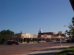
Downtown Oberlin (1999)
|
|
 Location within Decatur County and Kansas |
|
 KDOT map of Decatur County (legend) |
|
| Coordinates: 39°49′16″N 100°31′42″W / 39.82111°N 100.52833°W | |
| Country | United States |
| State | Kansas |
| County | Decatur |
| Founded | 1872 |
| Platted | 1878 |
| Incorporated | 1885 |
| Government | |
| • Mayor | Ladd Wendelin |
| • Administrator | Pete Kampfer |
| Area | |
| • Total | 1.91 sq mi (4.95 km2) |
| • Land | 1.91 sq mi (4.95 km2) |
| • Water | 0 sq mi (0 km2) |
| Elevation | 2,562 ft (781 m) |
| Population (2010) | |
| • Total | 1,788 |
| • Estimate (2015) | 1,761 |
| • Density | 940/sq mi (360/km2) |
| Time zone | CST (UTC-6) |
| • Summer (DST) | CDT (UTC-5) |
| ZIP code | 67749 |
| Area code | 785 |
| FIPS code | 20-52000 |
| GNIS feature ID | 0471014 |
| Website | OberlinKS.com |
Oberlin is a city in and the county seat of Decatur County, Kansas, United States. As of the 2010 census, the city population was 1,788.
Oberlin was platted as a town in 1878. It was named after Oberlin, Ohio.
The first post office in Oberlin was established in April, 1878.
On September 30, 1878, Northern Cheyenne fleeing from Indian Territory to their homes in the north, the Northern Cheyenne Exodus, attacked homesteaders near Oberlin, then a tiny hamlet. The Last Indian Raid in Kansas room in the Decatur County Museum and a monument in the town cemetery near the graves of the victims commemorate those depredations.
Oberlin was incorporated as a city in 1885.
Oberlin is located at 39°49′16″N 100°31′42″W / 39.82111°N 100.52833°WCoordinates: 39°49′16″N 100°31′42″W / 39.82111°N 100.52833°W (39.821235, -100.528369) at an elevation of 2,562 feet (781 m). It lies on the northwest side of Sappa Creek, a tributary of the Republican River, in the High Plains region of the Great Plains. Located at the intersection of U.S. Route 36 and U.S. Route 83 in northwest Kansas, Oberlin is 228 miles (367 km) northwest of Wichita, 238 miles (383 km) east of Denver, and 320 miles (510 km) west-northwest of Kansas City.
...
Wikipedia
