Oakland Hills Fire
| Oakland firestorm of 1991 | |
|---|---|

Infrared aerial photograph of the firestorm. The Highway 13/24 intersection is at center.
|
|
| Location | Oakland, California, United States |
| Coordinates | 37°51′40″N 122°13′19″W / 37.861124°N 122.221892°WCoordinates: 37°51′40″N 122°13′19″W / 37.861124°N 122.221892°W |
| Statistics | |
| Total area | 1,520 acres (620 ha) |
| Cost | $1.5 billion |
| Date(s) | October 19–20, 1991 |
| Cause | grass fire |
| Buildings destroyed |
2,843 single-family dwellings and 437 apartment and condominium units. |
| Fatalities | 25 confirmed |
| Injuries | 150 |
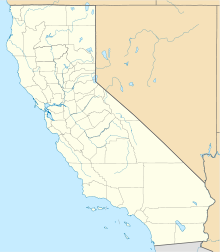
| Map | |
The Oakland firestorm of 1991 was a large suburban wildland-urban interface conflagration that occurred on the hillsides of northern Oakland, California, and southeastern Berkeley over the weekend of October 19–20, 1991. The official name of this incident by Cal Fire is the Tunnel fire. However, it is also commonly referred to as Oakland hills firestorm or the East Bay Hills Fire. The fire ultimately killed 25 people and injured 150 others. The 1,520 acres (620 ha) destroyed included 2,843 single-family dwellings and 437 apartment and condominium units. The economic loss has been estimated at $1.5 billion.
The fire started on Saturday, October 19, from an incompletely extinguished grass fire in the Berkeley Hills northeast of the intersection of California State Routes 24 and 13 (0.5 mi (0.8 km) north of the Caldecott Tunnel west portal). Firefighters fought the 5-acre (2.0 ha) fire on a steep hillside above 7151 Buckingham Blvd., and by Saturday night they thought everything was under control.
The fire re-ignited shortly before 11 a.m. on Sunday, October 20. It restarted as a brush fire and rapidly spread southwest driven by wind gusts up to 65 mi (100 km) per hour. It quickly overwhelmed local and regional firefighting resources. By 11:30 a.m., the fire had spread to the nearby Parkwoods Apartments located next to the Caldecott Tunnel. Shortly before noon the fire had been blown up to the top of Hiller Highlands to the west from where it began its sweep down into the Hiller Highlands development and the southern hills of Berkeley. The fire tossed embers from the burning houses and vegetation into the air as it went. These embers were swept away by the torrid winds only to float back to earth to start the blaze in new locations. Half an hour later, these embers enabled the fire to jump across both Highway 24, an eight-lane freeway, and Highway 13, a four-lane freeway, eventually igniting hundreds of houses in the Forest Park neighborhood on the northwest edge of the Montclair district and in the upper Rockridge neighborhood. The fire eventually touched the edge of Piedmont, burning some municipal property, but the buildings and houses were spared.
...
Wikipedia


