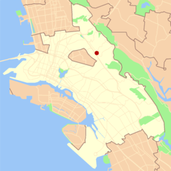
Montclair, Oakland, California
| Montclair | |
|---|---|
| Neighborhood of Oakland | |

A street view of Montclair Village
|
|
 Location in Oakland |
|
| Coordinates: 37°49′56″N 122°12′33″W / 37.832222°N 122.209167°W | |
| Country | United States |
| State | California |
| County | Alameda |
| City | Oakland |
Coordinates: 37°49′56″N 122°12′33″W / 37.83222°N 122.20917°W
Montclair (also known as the Montclair District or Montclair Village) is an affluent neighborhood in Oakland, California, United States. Montclair is located along the western slope of the Oakland Hills from a valley formed by the Hayward Fault to the upper ridge of the hills.
Although there is no formal definition of the neighborhood the general boundaries are Highway 24 to the north, Joaquin Miller Road to the south, the city of Piedmont to the west and the Contra Costa County border to the east. The center of the neighborhood is a compact shopping district known as Montclair Village which is located next to Highway 13 in the bottom of the valley. It lies at an elevation of 640 feet (195 m).
The hills of Montclair are heavily forested and generally characterized by winding streets and large single-family houses, homes ranging from small but expensive cottages to mansions and estates. A few small apartment and condominium complexes are located in Montclair, primarily in the Village area. Large single-family homes dominate the housing stock, and the neighborhood includes a wide array of styles –– mid-century modern, Danish modern, Tudor, Mediterranean-Spanish/French, rustic, post-modern, craftsman, and the like, all comprising some of Oakland's largest and most expensive homes.
...
Wikipedia
