Oakland, Nebraska
| Oakland, Nebraska | |
|---|---|
| City | |
![Swedish Heritage Center, occupying former Swedish Covenant Church in Oakland[1]](http://upload.wikimedia.org/wikipedia/commons/thumb/6/6d/Oakland%2C_Nebraska_Swedish_Heritage_Center.JPG/250px-Oakland%2C_Nebraska_Swedish_Heritage_Center.JPG)
Swedish Heritage Center, occupying former Swedish Covenant Church in Oakland
|
|
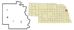
 Location of Oakland, Nebraska |
|
| Coordinates: 41°50′6″N 96°27′58″W / 41.83500°N 96.46611°WCoordinates: 41°50′6″N 96°27′58″W / 41.83500°N 96.46611°W | |
| Country | United States |
| State | Nebraska |
| County | Burt |
| Area | |
| • Total | 0.93 sq mi (2.41 km2) |
| • Land | 0.93 sq mi (2.41 km2) |
| • Water | 0 sq mi (0 km2) |
| Elevation | 1,293 ft (394 m) |
| Population (2010) | |
| • Total | 1,244 |
| • Estimate (2012) | 1,207 |
| • Density | 1,337.6/sq mi (516.5/km2) |
| Time zone | Central (CST) (UTC-6) |
| • Summer (DST) | CDT (UTC-5) |
| ZIP code | 68045 |
| Area code(s) | 402 |
| FIPS code | 31-35490 |
| GNIS feature ID | 0831822 |
| Website | www.ci.oakland.ne.us |
Oakland is a city in Burt County, Nebraska, United States. The population was 1,244 at the 2010 census. Oakland continues to build on its strong foundation with its bi-annual Swedish Festival and is known by its proclamation from the Swedish Consul-General and Nebraska Governor as the "Swedish Capital of Nebraska."
Oakland is located at 41°50′6″N 96°27′58″W / 41.83500°N 96.46611°W (41.835133, -96.466075). According to the United States Census Bureau, the city has a total area of 0.93 square miles (2.41 km2), all of it land.
Oakland was named after John Oak, an early settler. The village was incorporated April 13, 1881, with 30 businesses, two banks and one printing office in operation. Basic economic activities in the Oakland area soon included farming, cattle and hog production, feed processing, wholesale and retail sales. In 1900, the Chicago, Burlington and Quincy Railroad were built to Oakland.
Oakland was home to the Swedish Basketball Classic from 1993-2006, which has since moved to Midland University in Fremont, NE and changed its name to the Warrior Classic. Oakland has also been home to the Burt County Fair since 1913.
As of the census of 2010, there were 1,244 people, 528 households, and 343 families residing in the city. The population density was 1,337.6 inhabitants per square mile (516.5/km2). There were 633 housing units at an average density of 680.6 per square mile (262.8/km2). The racial makeup of the city was 96.0% White, 0.5% African American, 1.3% Native American, 0.9% Asian, and 1.4% from two or more races. Hispanic or Latino of any race were 0.6% of the population.
...
Wikipedia
