O'Fallon, Missouri
| O'Fallon, Missouri | ||
|---|---|---|
| City | ||
|
||
| Motto: Tradition with Vision | ||
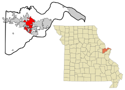
 Location in the state of Missouri |
||
| Coordinates: 38°47′04″N 90°42′29″W / 38.78444°N 90.70806°WCoordinates: 38°47′04″N 90°42′29″W / 38.78444°N 90.70806°W | ||
| Country | United States | |
| State |
|
|
| County | St. Charles | |
| Metro | Greater St. Louis | |
| First Settled | 1856 | |
| Incorporated | September 25, 1912 | |
| Government | ||
| • Type | Mayor-council government | |
| • Mayor | Bill Hennessy | |
| • City Council |
List
|
|
| Area | ||
| • City | 29.20 sq mi (75.63 km2) | |
| • Land | 29.19 sq mi (75.60 km2) | |
| • Water | 0.01 sq mi (0.03 km2) | |
| Elevation | 541 ft (165 m) | |
| Population (2010) | ||
| • City | 79,329 | |
| • Estimate (2013) | 82,809 | |
| • Density | 2,717.7/sq mi (1,049.3/km2) | |
| • Metro | 2,810,056 (US: 19th) | |
| Time zone | CST (UTC-6) | |
| • Summer (DST) | CDT (UTC-5) | |
| ZIP code | 63366, 63368 | |
| Area code(s) | 636 | |
| FIPS code | 29-54074 | |
| GNIS feature ID | 0756460 | |
| Website | http://www.ofallon.mo.us/ | |
O'Fallon /oʊˈfælən/ is a city along Interstate 70 and Interstate 64 between Lake St. Louis and St. Peters in St. Charles County, Missouri. It is part of the St. Louis Metropolitan Statistical Area. As of the 2010 census O'Fallon had a population of 79,329, making it the largest municipality in St. Charles County and seventh largest in the state of Missouri. In 2006 Money Magazine named O'Fallon 39th in its "Best 100 Places to Live."Money Magazine also ranked O'Fallon 68th out of 100 in 2008 and 26th out of 100 in 2010.
O'Fallon's namesake in St. Clair County, Illinois is also part of the St. Louis Metropolitan Statistical Area. The two O'Fallons are one of the few pairs of same-named municipalities to be part of the same MSA.
O'Fallon was platted in 1857. The community has the name of John O'Fallon, a railroad official. A post office called O'Fallon has been in operation since 1859.
The St. Mary's Institute of O'Fallon was listed on the National Register of Historic Places in 2007.
According to the United States Census Bureau, the city has a total area of 29.20 square miles (75.63 km2), of which, 29.19 square miles (75.60 km2) is land and 0.01 square miles (0.03 km2) is water.
...
Wikipedia

