Nuth
|
Nuth Nut |
|||
|---|---|---|---|
| Municipality | |||

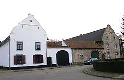
Old farmhouse in Arensgenhout
|
|||
|
|||
 Location in Limburg |
|||
| Coordinates: 50°55′N 5°53′E / 50.917°N 5.883°ECoordinates: 50°55′N 5°53′E / 50.917°N 5.883°E | |||
| Country | Netherlands | ||
| Province | Limburg | ||
| Government | |||
| • Body | Municipal council | ||
| • Mayor | Désirée Schmalschläger (GroenLinks) | ||
| Area | |||
| • Total | 33.13 km2 (12.79 sq mi) | ||
| • Land | 33.09 km2 (12.78 sq mi) | ||
| • Water | 0.04 km2 (0.02 sq mi) | ||
| Elevation | 86 m (282 ft) | ||
| Population (May 2014) | |||
| • Total | 15,583 | ||
| • Density | 471/km2 (1,220/sq mi) | ||
| Demonym(s) | Nutter | ||
| Time zone | CET (UTC+1) | ||
| • Summer (DST) | CEST (UTC+2) | ||
| Postcode | 6333, 6336, 6360–6363 | ||
| Area code | 045 | ||
| Website | www |
||
Nuth (Dutch pronunciation: [nɵt]; Limburgish: Nut) is a municipality and a village in the province of Limburg, situated in the southern Netherlands.
The village of Nuth has 5,548 inhabitants, and is with that the largest village of the municipality. The town hall of the municipality Nuth is also situated in the village Nuth. The other villages in the municipality are Hulsberg with 4,300 inhabitants, Schimmert with 3,339, Wijnandsrade with 1,812 and Vaesrade with 1,027 inhabitants (data: 1-1-2005). The other population centres belong to one of the following villages.
Aalbeek, Arensgenhout, Grijzegrubben, Helle, Hellebroek, Hulsberg, Laar, Schimmert, Swier, Terstraten, Vaesrade, Wijnandsrade.
Dutch Topographic map of the municipality of Nuth, June 2015
...
Wikipedia


