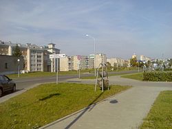
Nowogródek
| Навагрудак / Navahrudak | |||
|---|---|---|---|
 |
|||
|
|||
|
|
|||
| Coordinates: 53°35′N 25°49′E / 53.583°N 25.817°E | |||
|
Country Subdivision |
Belarus Navahradak |
||
| Founded | 1044 | ||
| Elevation | 292 m (958 ft) | ||
| Population (2009) | |||
| • Total | 29,336 | ||
| Time zone | EET (UTC+2) | ||
| • Summer (DST) | EEST (UTC+3) | ||
| Postal code | 231241, 231243, 231244, 231246, 231400 | ||
| Area code(s) | +375 1597 | ||
| License plate | 4 | ||
| Website | Official website | ||

Location of Navahrudak within the Hrodna Voblast, in light red.
Navahrudak (Belarusian: Навагрудак, [navaˈɣrudak]; Russian: Новогрудок; Polish: Nowogródek; Lithuanian: Naugardukas; Yiddish: נאָווהאַרדאָק Novhardok) is a city in the Grodno Region of Belarus. In the 14th century it was an episcopal see of the Metropolitanate of Lithuania. It is a possible first capital of the Grand Duchy of Lithuania, with Trakai also noted as a possibility.
It was first mentioned in the Sophian First Chronicle and Fourth Novgorod Chronicle in 1044 in relation to a war of Yaroslav I the Wise against Lithuanian tribes. In 1241 it was destroyed by the Mongols. It was also mentioned in the Hypatian Codex under the year of 1252 as Novogorodok (i.e. "new little town") the town was a major settlement in the remote western lands of the Krivichs that came under the control of the Kievan Rus at the end of the 10th century. Later hypothesis is disputed, as there are earliest archaeological findings from 11th century only.
...
Wikipedia


