Northfield Township, Michigan
| Northfield Township, Michigan | |
|---|---|
| Township | |

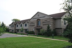
Township Hall, Main St.
|
|
| Motto: Planning for our future, preserving our past | |
| Location within the state of Michigan | |
| Coordinates: 42°24′2″N 83°44′36″W / 42.40056°N 83.74333°WCoordinates: 42°24′2″N 83°44′36″W / 42.40056°N 83.74333°W | |
| Country | United States |
| State | Michigan |
| County | Washtenaw |
| Area | |
| • Total | 36.7 sq mi (95.0 km2) |
| • Land | 35.8 sq mi (92.6 km2) |
| • Water | 0.9 sq mi (2.3 km2) |
| Elevation | 912 ft (278 m) |
| Population (2010) | |
| • Total | 8,245 |
| • Density | 220/sq mi (87/km2) |
| Time zone | Eastern (EST) (UTC-5) |
| • Summer (DST) | EDT (UTC-4) |
| FIPS code | 26-58280 |
| GNIS feature ID | 1626812 |
| Website | twp-northfield |
Northfield Township is a civil township of Washtenaw County, located north of Ann Arbor in the U.S. state of Michigan. The population was 8,245 at the 2010 census. The unincorporated community of Whitmore Lake lies within the northern portion of the township, on its border with Green Oak township in Livingston County.
Northfield Township was established in 1832, when the Territorial Legislature held a meeting in Detroit, and passed the resolution which brought it into existence. The name, popularly believed to refer to the fact that the township is in the northern part of the county, also points back to the New England heritage of many of its first settlers, whose practice it was to bring part of their homeland with them by naming new places after the ones they had left. Northfield Township could quite possibly be named after the New England site - Northfield, Massachusetts. However, that the town is in the "northern fields" of the county must have made the name seem quite appropriate.
According to the United States Census Bureau, the township has a total area of 36.7 square miles (95.0 km2), of which 35.8 square miles (92.6 km2) is land and 0.89 square miles (2.3 km2), or 2.45%, is water.
As of the census of 2000, there were 8,252 people, 3,154 households, and 2,236 families residing in the township. The population density was 227.4 per square mile (87.8/km²). There were 3,393 housing units at an average density of 93.5 per square mile (36.1/km²). The racial makeup of the township was 96.13% White, 1.07% African American, 0.46% Native American, 0.57% Asian, 0.12% Pacific Islander, 0.23% from other races, and 1.42% from two or more races. Hispanic or Latino of any race were 1.08% of the population.
...
Wikipedia

